Dallas
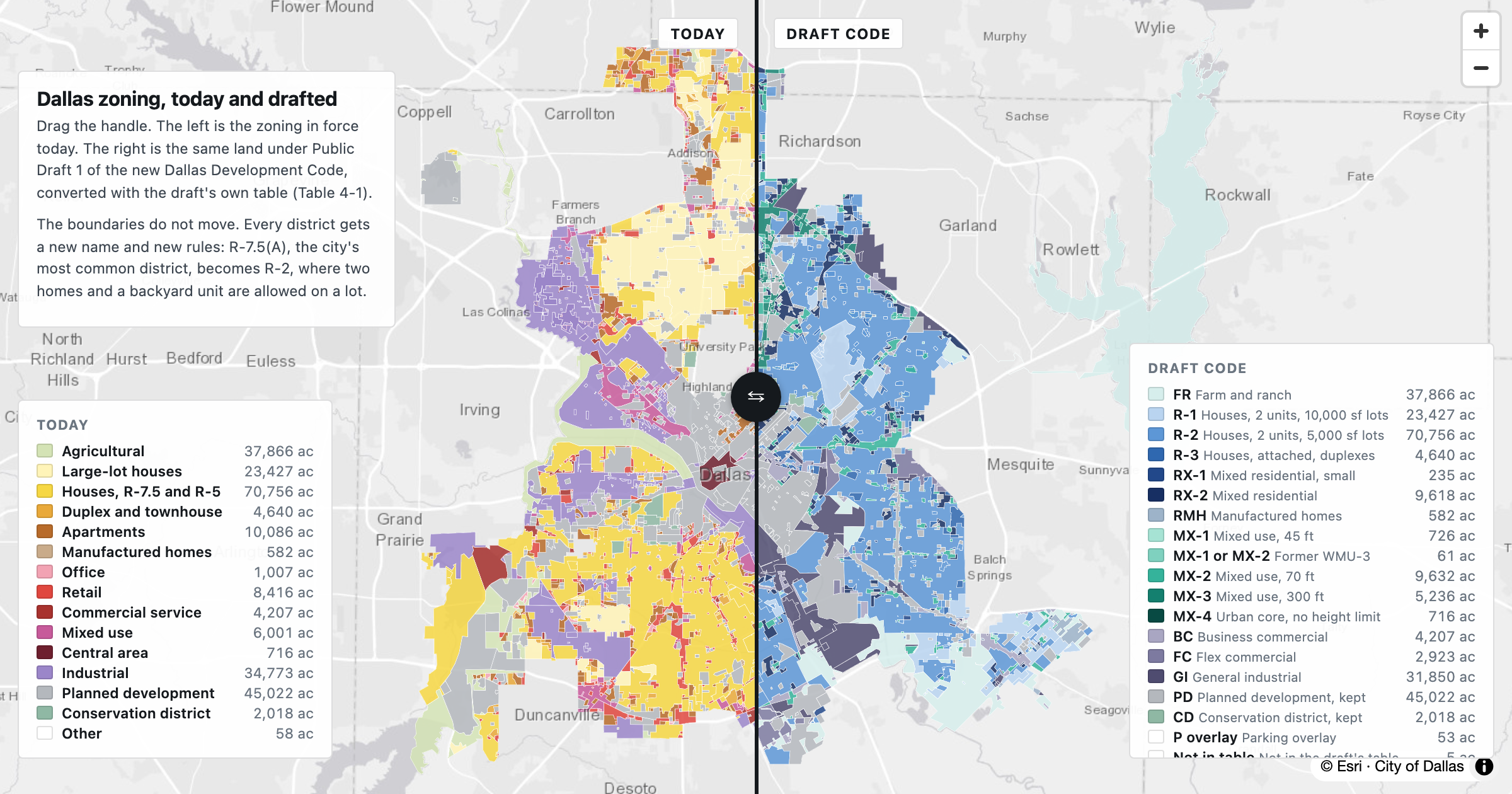
Dallas zoning, today and drafted
Swipe between Dallas zoning today and the same land under Public Draft 1 of the new development code, converted with the draft's own table. The boundaries stay; the rulebook changes.
The maps behind The Texas Atlas. Each one started with a question about Texas; open any of them to explore it yourself, or read the story it came from.
Dallas
Swipe between Dallas zoning today and the same land under Public Draft 1 of the new development code, converted with the draft's own table. The boundaries stay; the rulebook changes.
Dallas
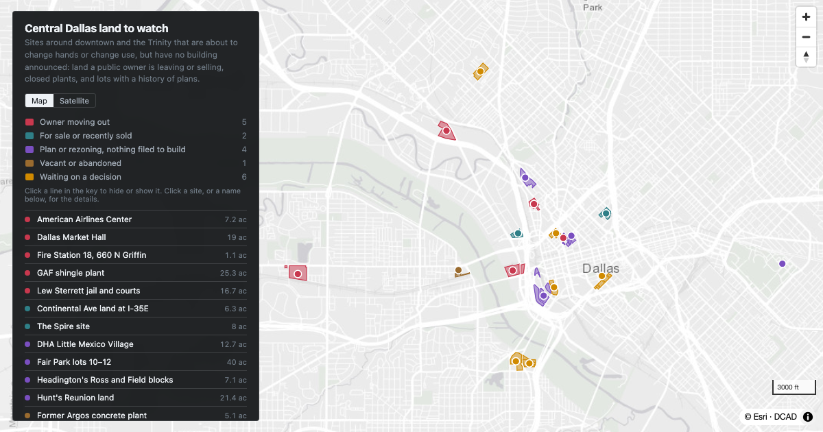
Land in central Dallas that is about to change hands or change use, with no building announced yet: the county jail site, public land up for disposal, closed plants, and downtown lots with a history of plans.
DFW
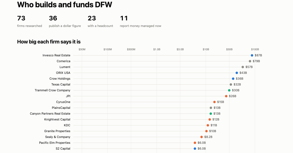
The developers, investors and lenders behind Dallas–Fort Worth real estate: how big each says it is, how many people it employs, and what it invests in. Every figure labelled by what it measures, with its source.
Dallas
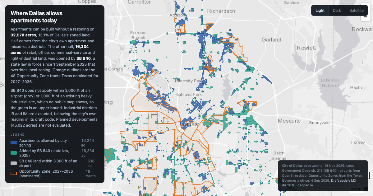
Apartments are allowed without a rezoning on 32,578 acres of Dallas, 13.1% of zoned land. Half of it, 16,334 acres of retail, office and commercial land, was opened by state law (SB 840) in September 2025.
Dallas
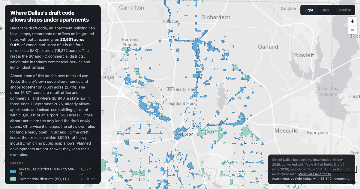
Under Public Draft 1, an apartment building can have shops on the ground floor, by right, on 23,501 acres, 9.4% of Dallas's zoned land. All but 538 of those acres already allow it today, through city zoning or SB 840.
Dallas
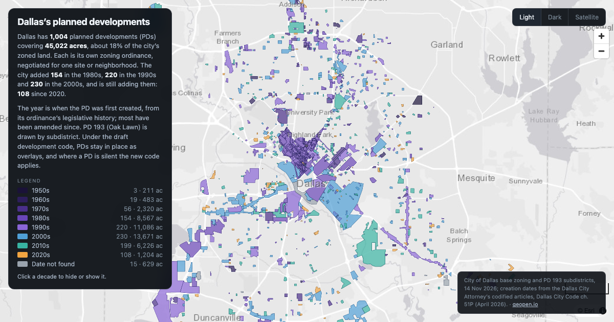
Dallas has 1,004 planned developments covering 45,022 acres, each its own zoning ordinance. The 2000s added the most: 230.
Dallas
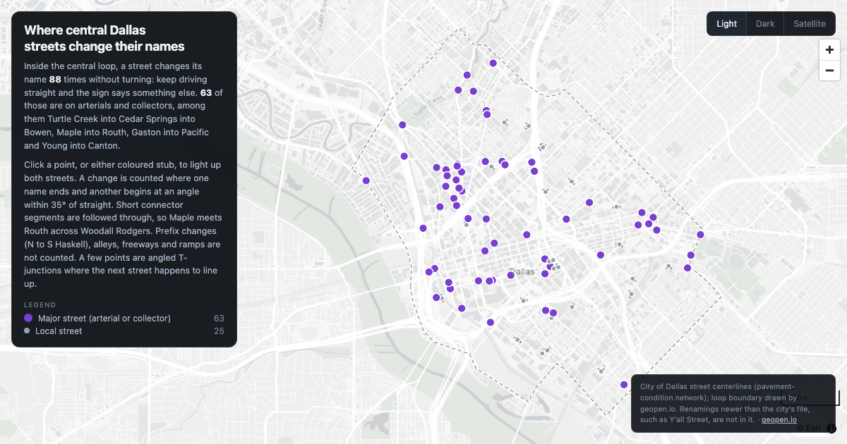
88 places inside central Dallas where a street changes its name without turning, 63 of them on major streets.
Dallas
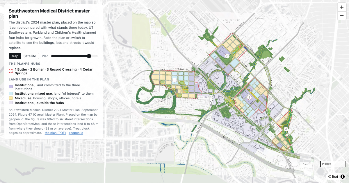
The Southwestern Medical District's 2024 master plan, placed on the map. Four hubs around UT Southwestern, Parkland and Children's Health, drawn over the streets and buildings that are there today.
Dallas
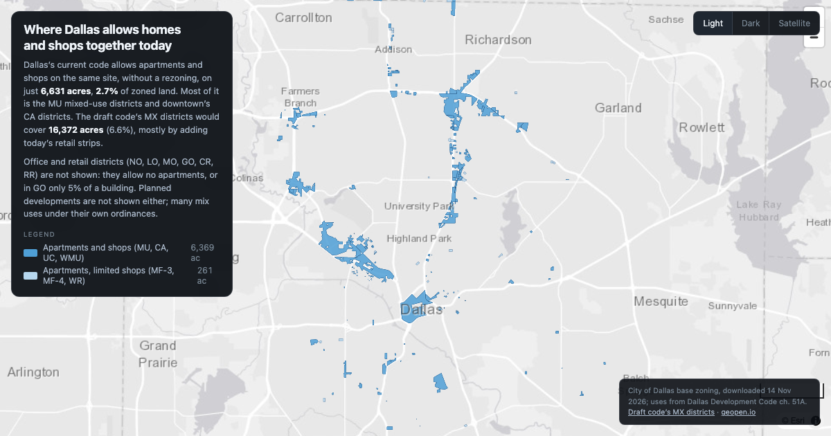
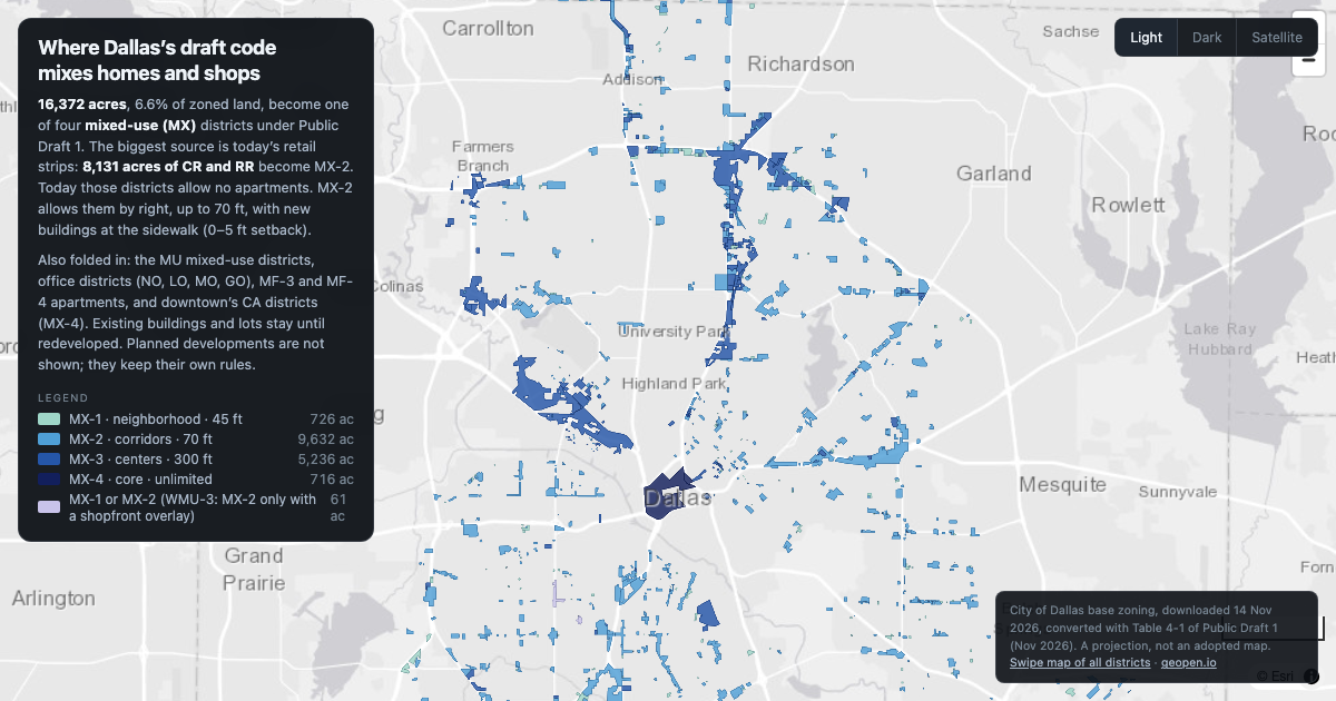
Under today's code, apartments and shops can share a site by right on 6,631 acres, 2.7% of Dallas's zoned land. The draft code would raise that to 16,372 acres (6.6%).
Dallas
The draft Dallas code converts 16,372 acres to four mixed-use (MX) districts. 8,131 acres of it are today’s retail strips, where apartments are not allowed now and would be allowed by right.
Houston
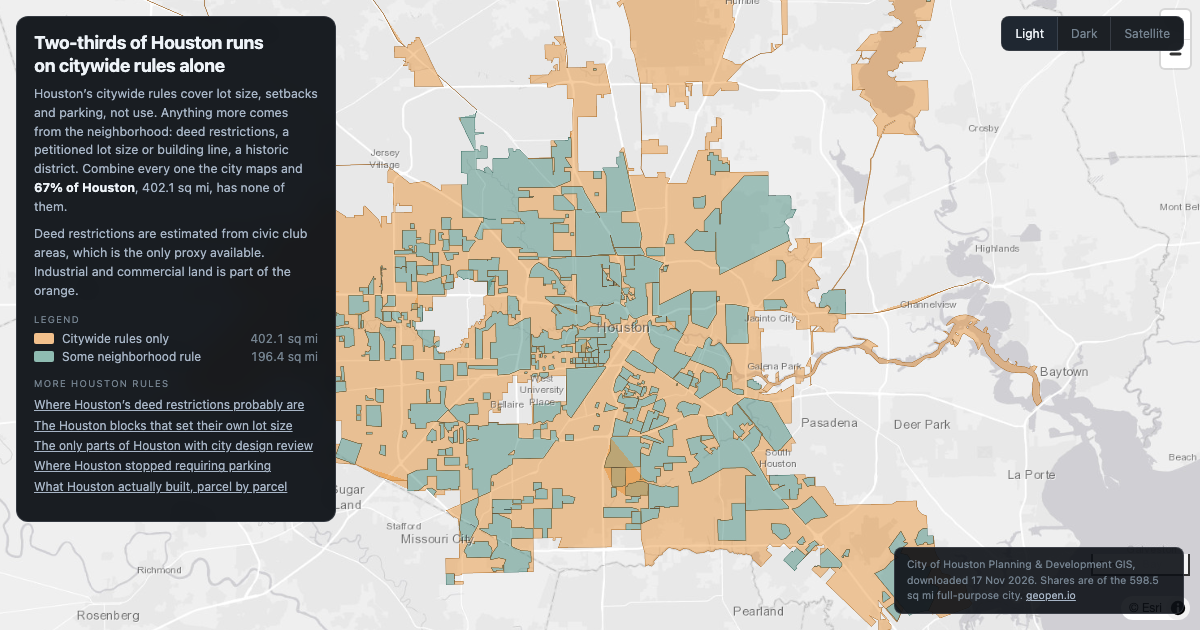
67% of Houston, 402.1 sq mi, has no mapped neighborhood rule (no civic club, petitioned lot size, building line or historic district), only the citywide rules on lots, setbacks and parking.
Houston
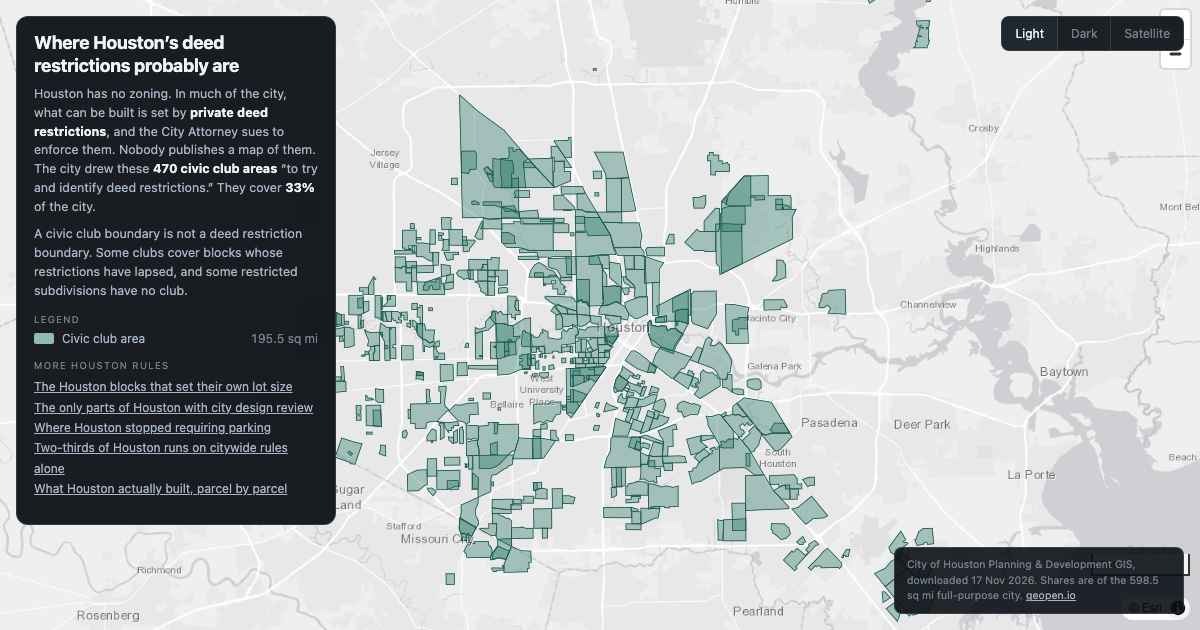
Houston has no zoning. Private deed restrictions do the job, and nobody maps them. The city’s 470 civic club areas, drawn to find them, cover 33% of the city.
Houston
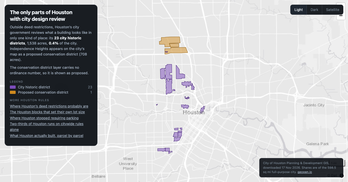
Houston reviews what buildings look like in just 23 city historic districts, 1,538 acres, 0.4% of the city.
Houston
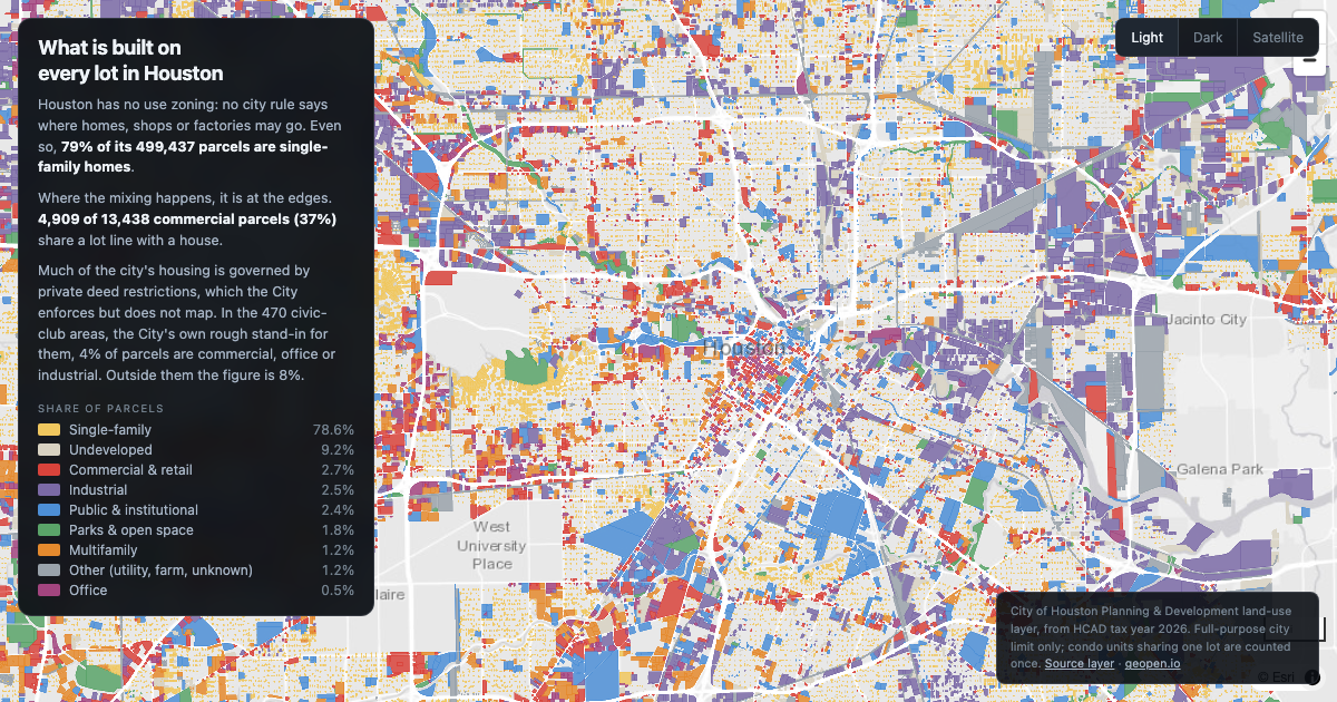
Houston has no use zoning, yet 79% of its 499,437 parcels are single-family homes, and 4,909 of its 13,438 commercial parcels (37%) share a lot line with a house.
Houston
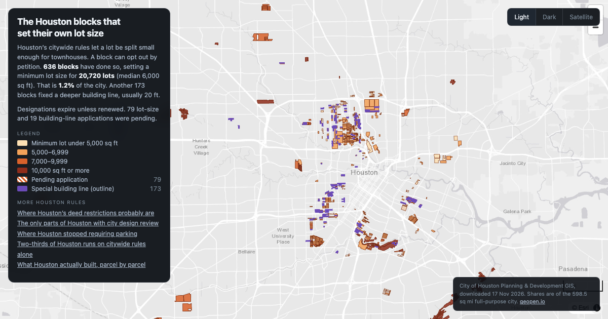
636 Houston blocks have petitioned for a minimum lot size, covering 20,720 lots and 1.2% of the city. Median minimum: 6,000 sq ft.
Houston
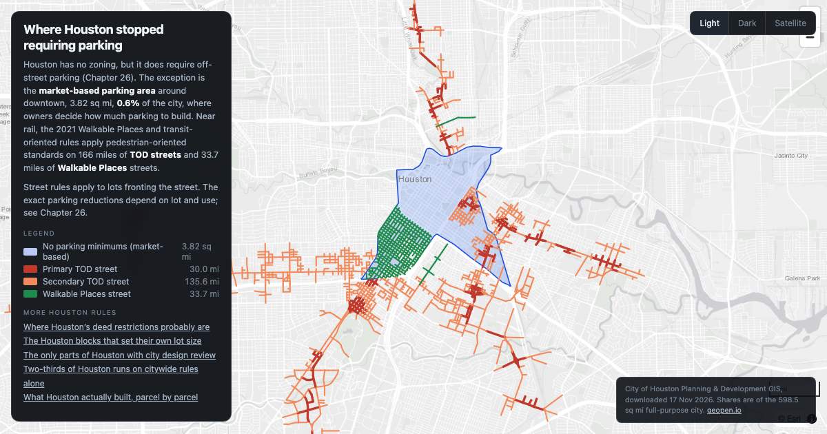
Houston dropped parking minimums in a 3.82 sq mi area around downtown, and set walkable-street rules on 166 miles of streets near rail.
Dallas
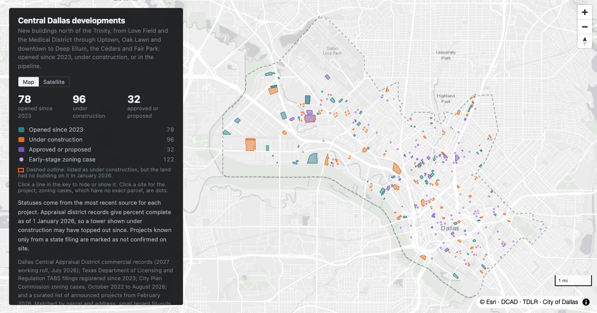
New development in central Dallas north of the Trinity: downtown, Uptown, Oak Lawn, Deep Ellum, the Cedars, the Design District, the Medical District, Love Field and Fair Park. What has opened since 2023, what is under construction, and what is approved or proposed.
Dallas
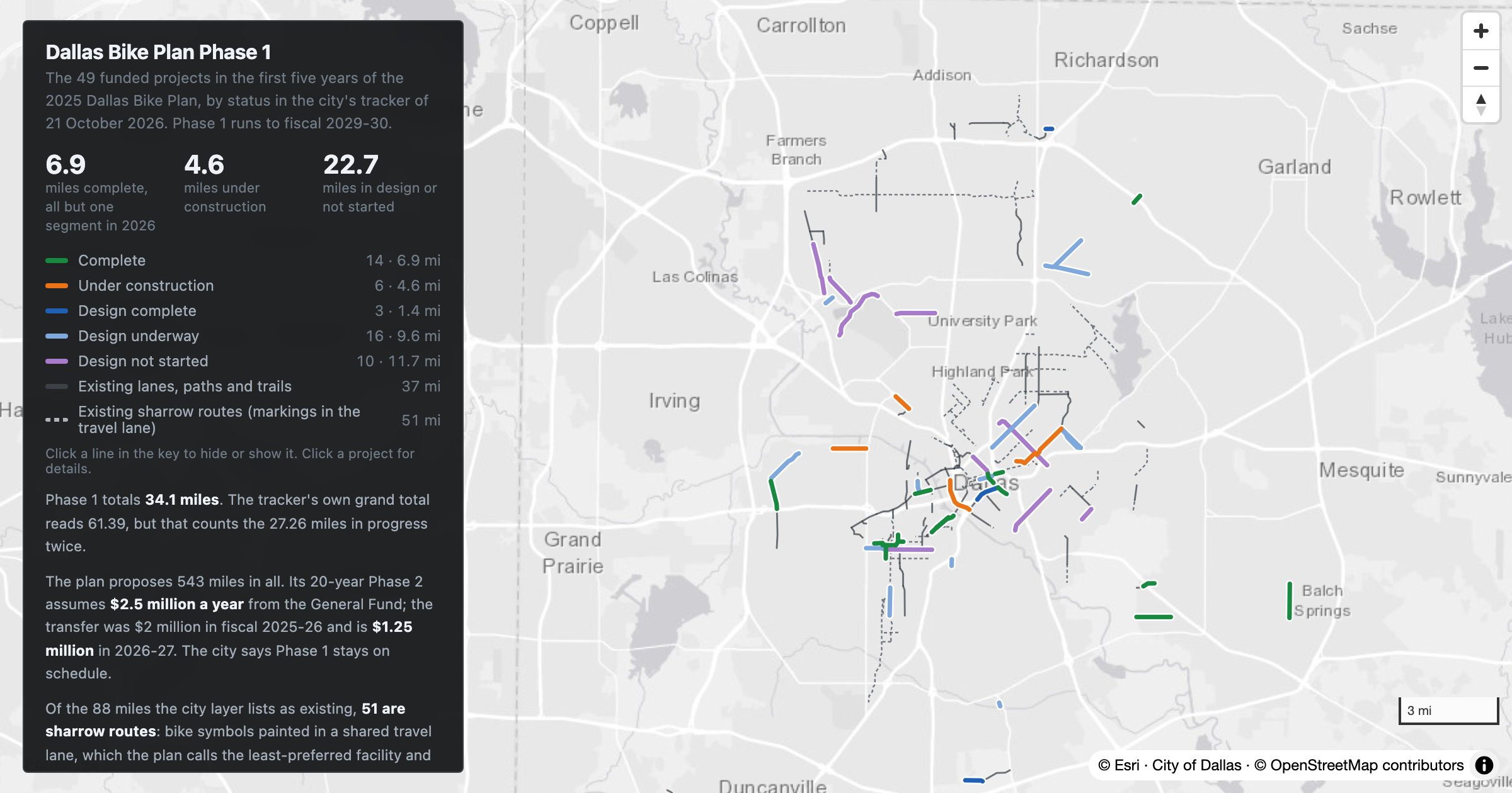
Every funded Phase 1 project in the 2025 Dallas Bike Plan, by status as of October 2026: 6.9 miles complete, 4.6 under construction and 22.7 still in design or not started.
Dallas
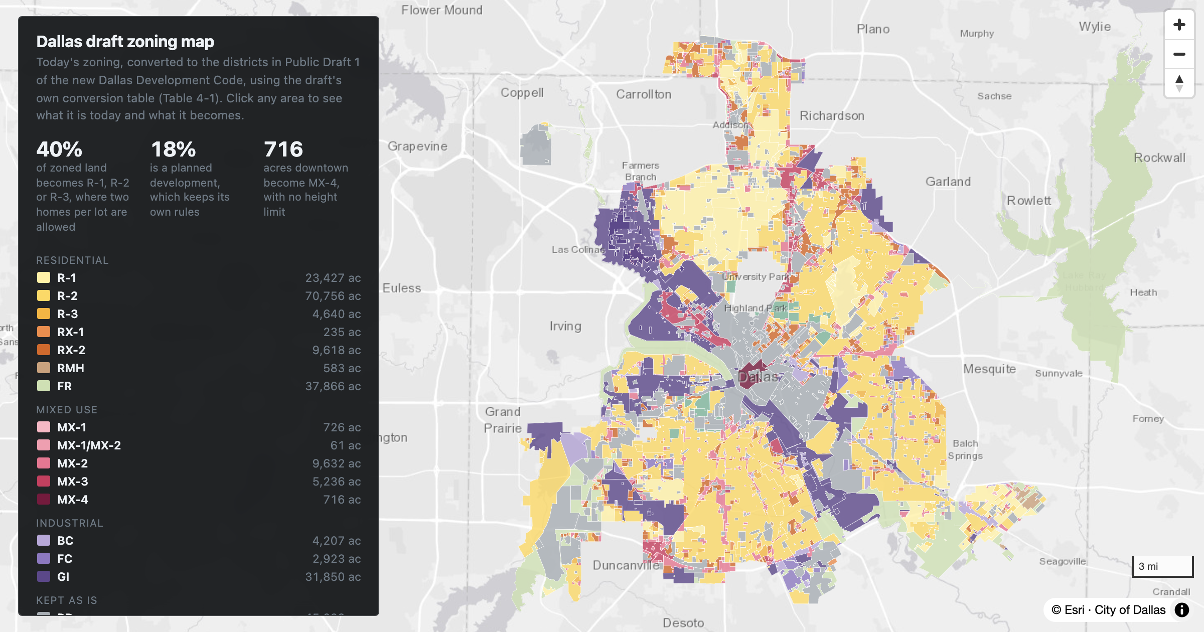
Today's Dallas zoning, converted to the districts in the November 2026 draft development code using the draft's own conversion table. Forty percent of the city's zoned land becomes R-1, R-2 or R-3, where two homes per lot are allowed.
Dallas
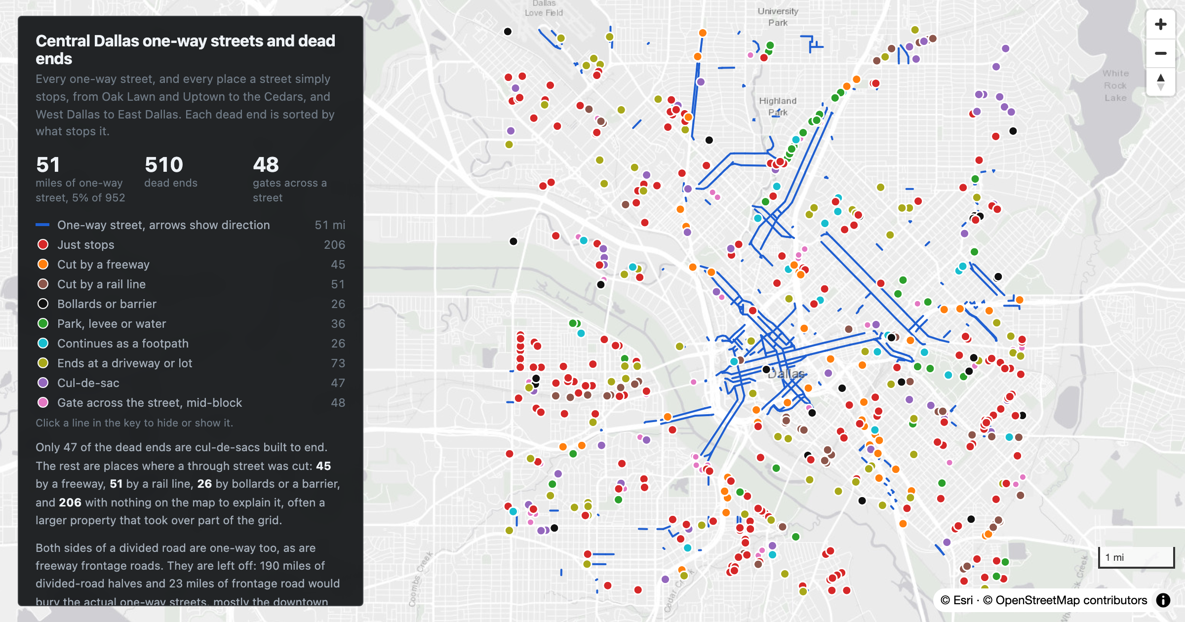
Every one-way street and dead end in central Dallas from OpenStreetMap: 51 miles of one-way streets and 510 places where a street simply stops, each classified by what stops it.
Dallas
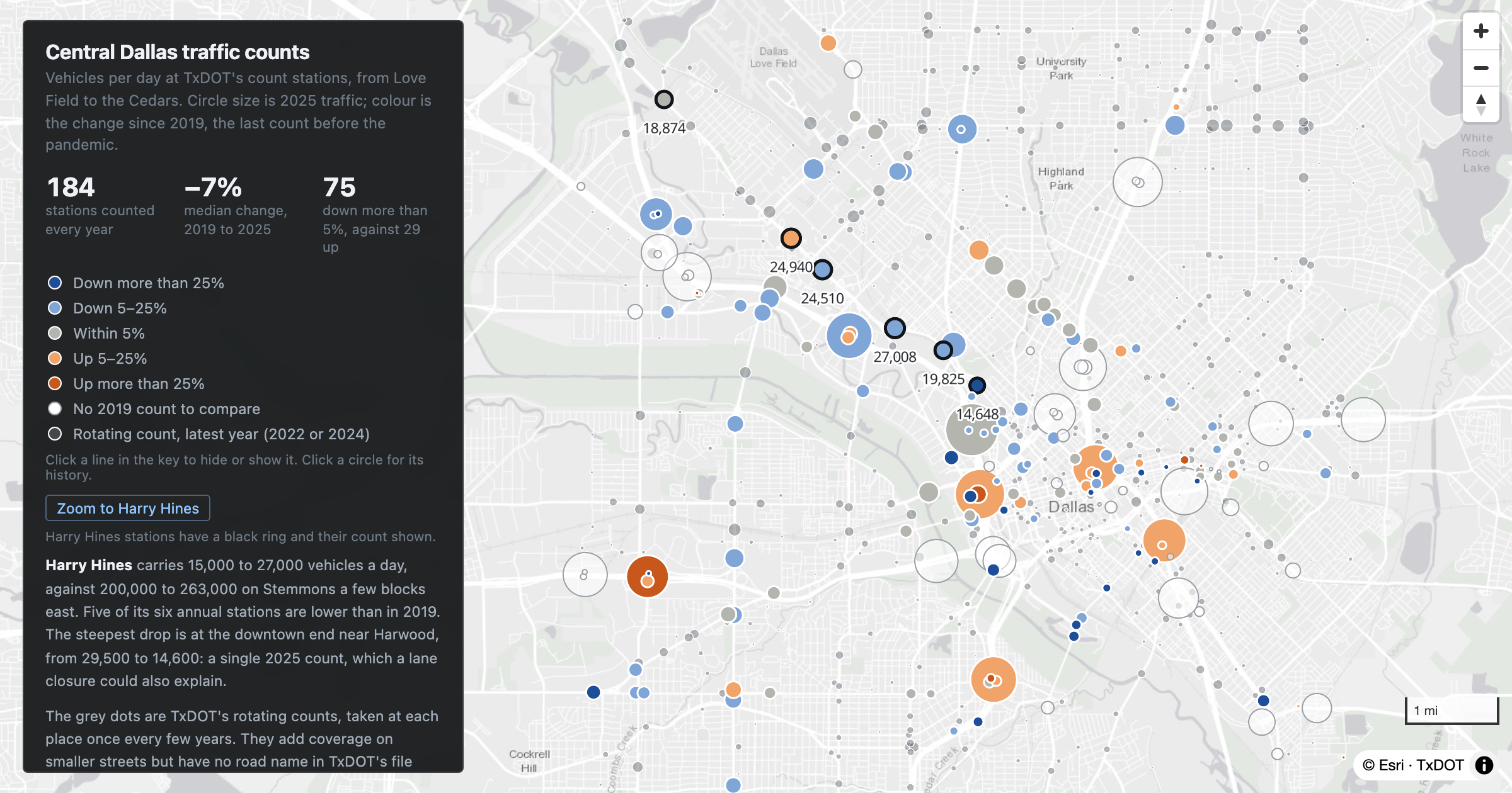
TxDOT's traffic count stations in central Dallas: vehicles per day in 2025, change since 2019, and each station's history back to 2013. Harry Hines carries 15,000 to 27,000 vehicles a day, down at five of its six annual stations.
Dallas
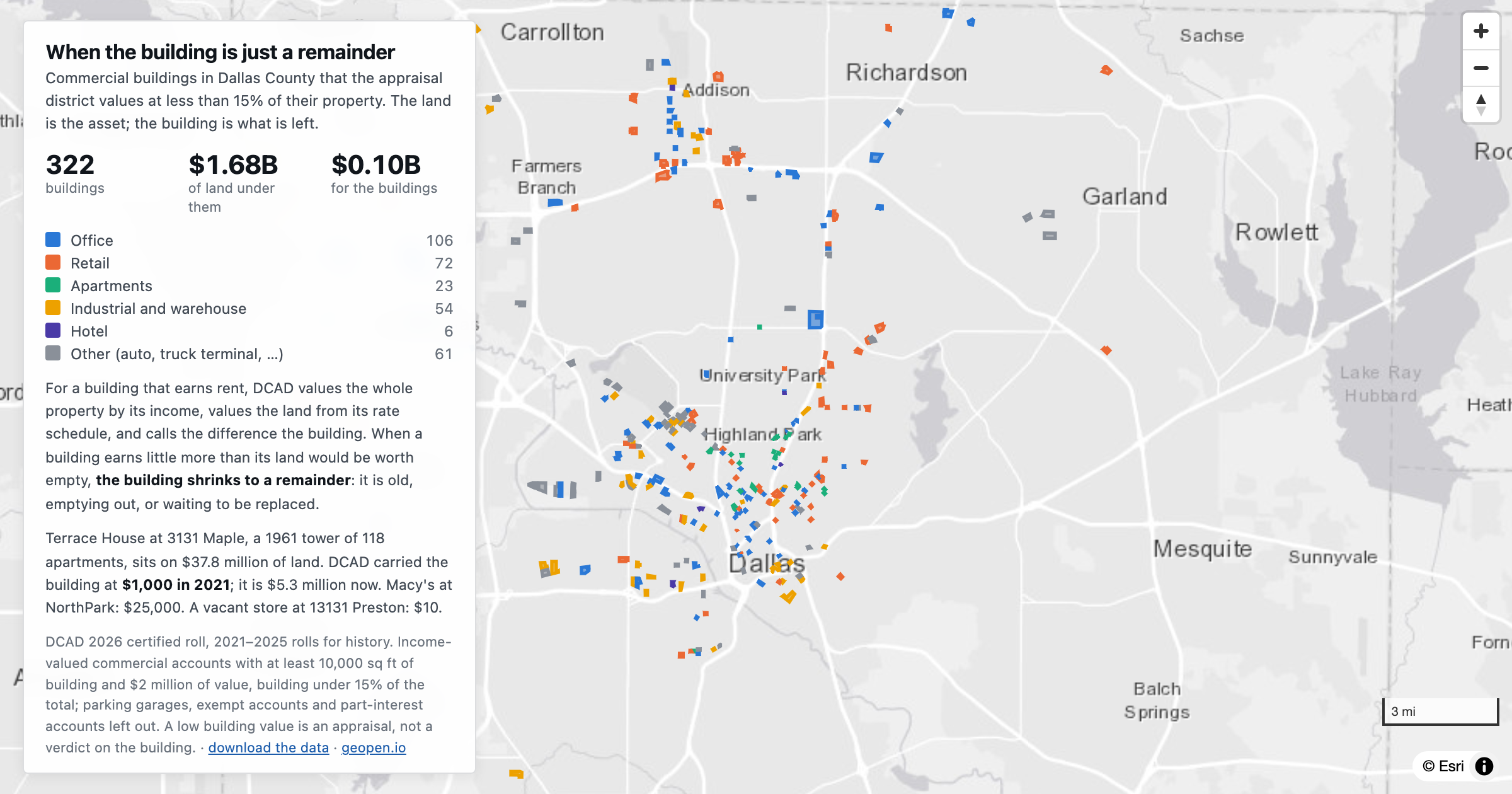
322 Dallas County commercial buildings that the appraisal district values at under 15% of their property: $1.68 billion of land under $0.10 billion of buildings.
Dallas
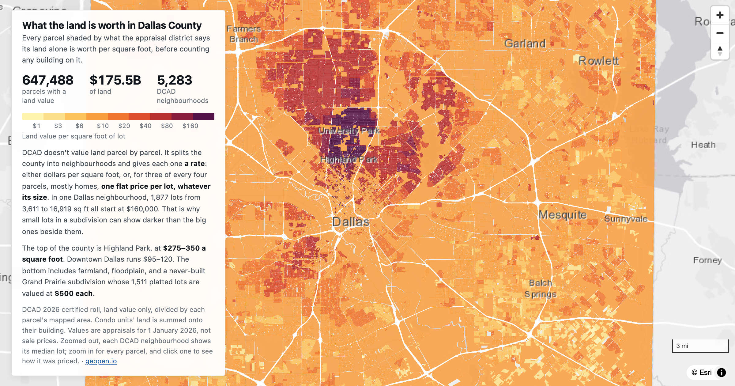
Every parcel in Dallas County shaded by what the appraisal district says its land alone is worth per square foot, from cents in the south of the county to $350 in Highland Park.
Dallas
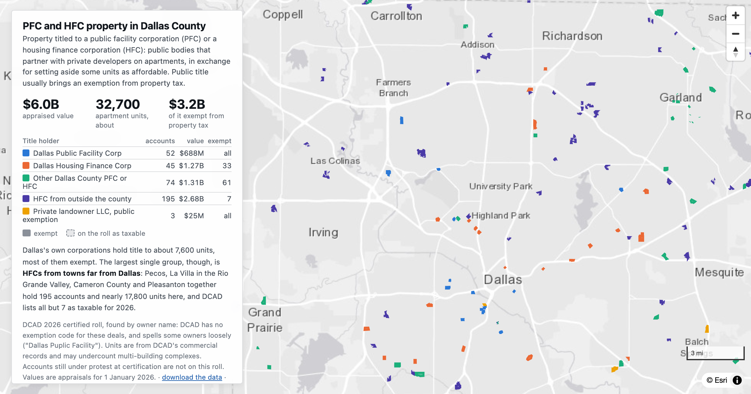
369 Dallas County property accounts titled to public facility corporations and housing finance corporations: $6.0 billion and about 32,700 apartment units, from the DCAD 2026 roll.
Dallas
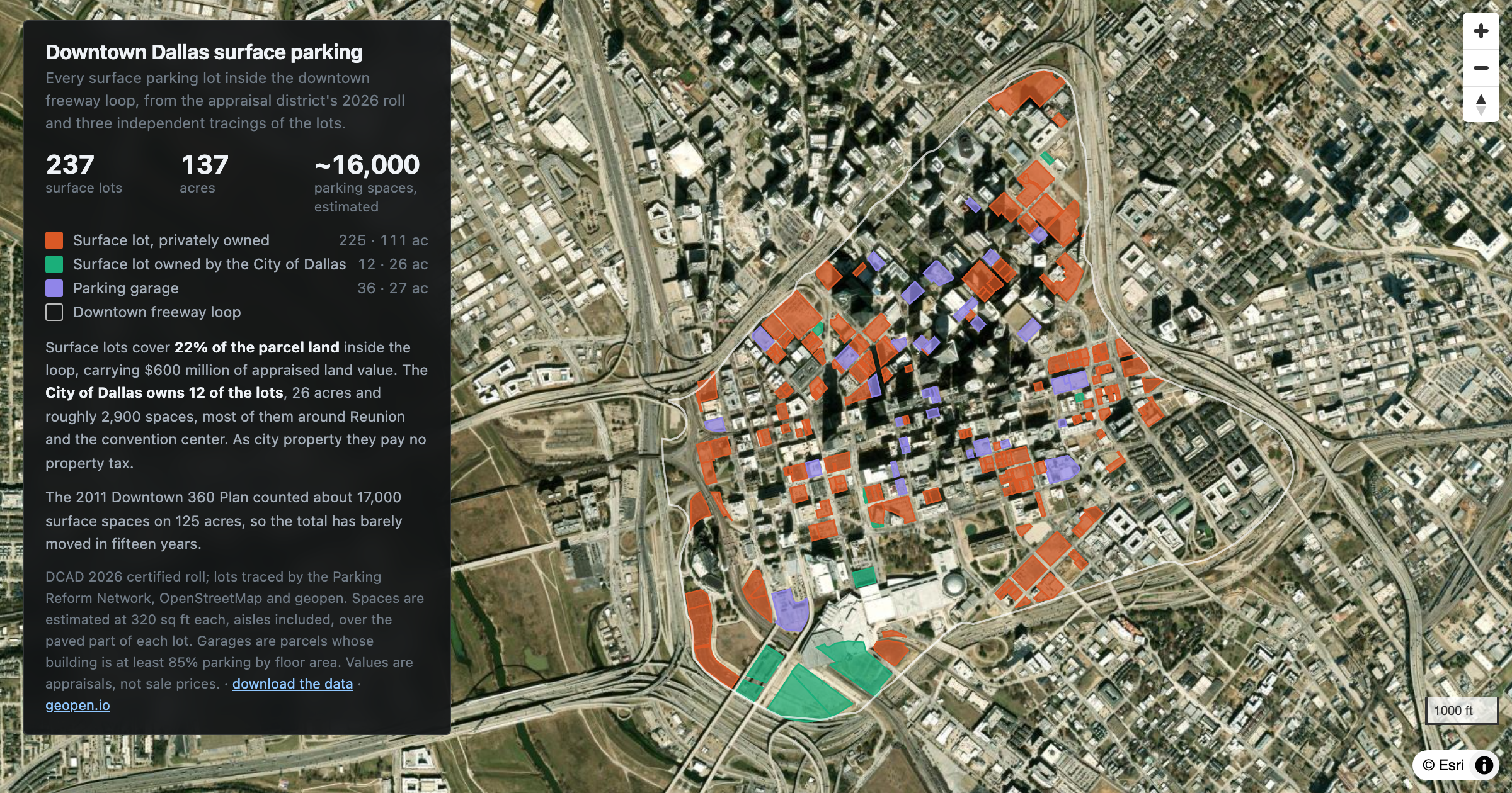
237 surface parking lots inside the downtown Dallas freeway loop: 137 acres and an estimated 16,000 spaces, from the DCAD 2026 roll.
Dallas
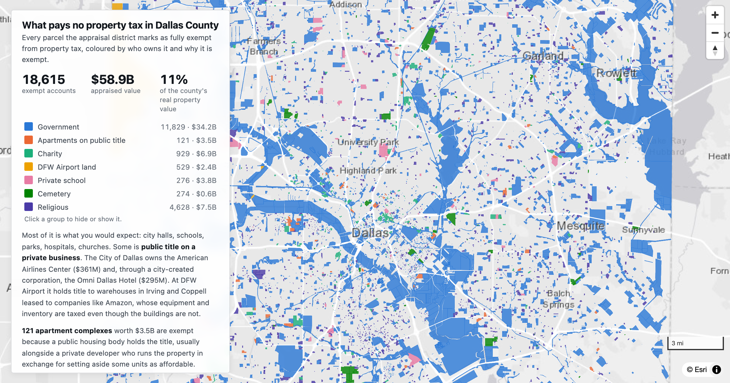
18,615 Dallas County property accounts, appraised at $58.9 billion, are fully exempt from property tax: government, churches, charities, private schools, public-title apartments and DFW Airport land.
Dallas
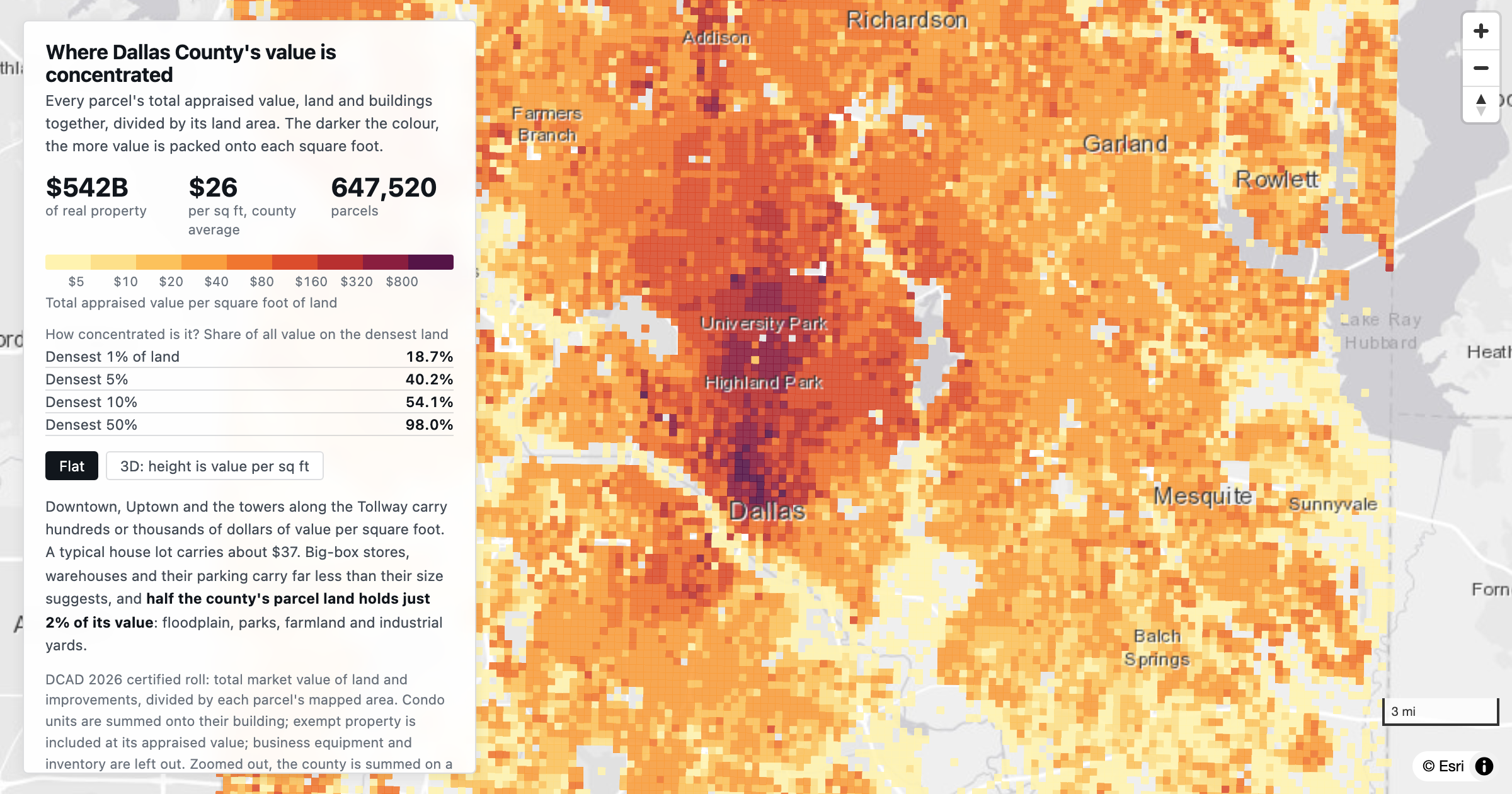
Total appraised value, land plus buildings, per square foot of land for every parcel in Dallas County. The densest 1% of land carries 18.7% of all value.
Dallas
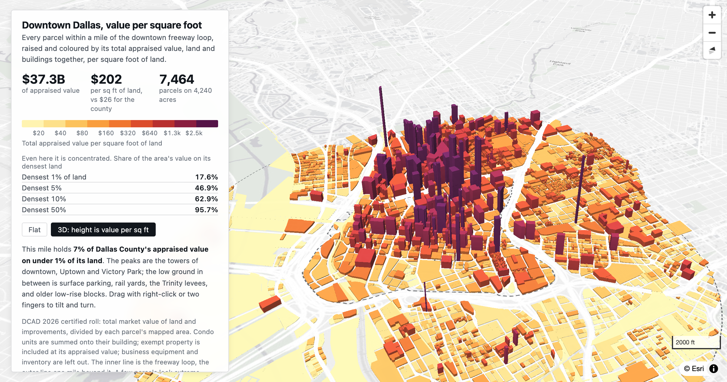
Total appraised value per square foot of land for 7,464 parcels in downtown Dallas and the mile around it: $37.3 billion on 4,240 acres.
Dallas
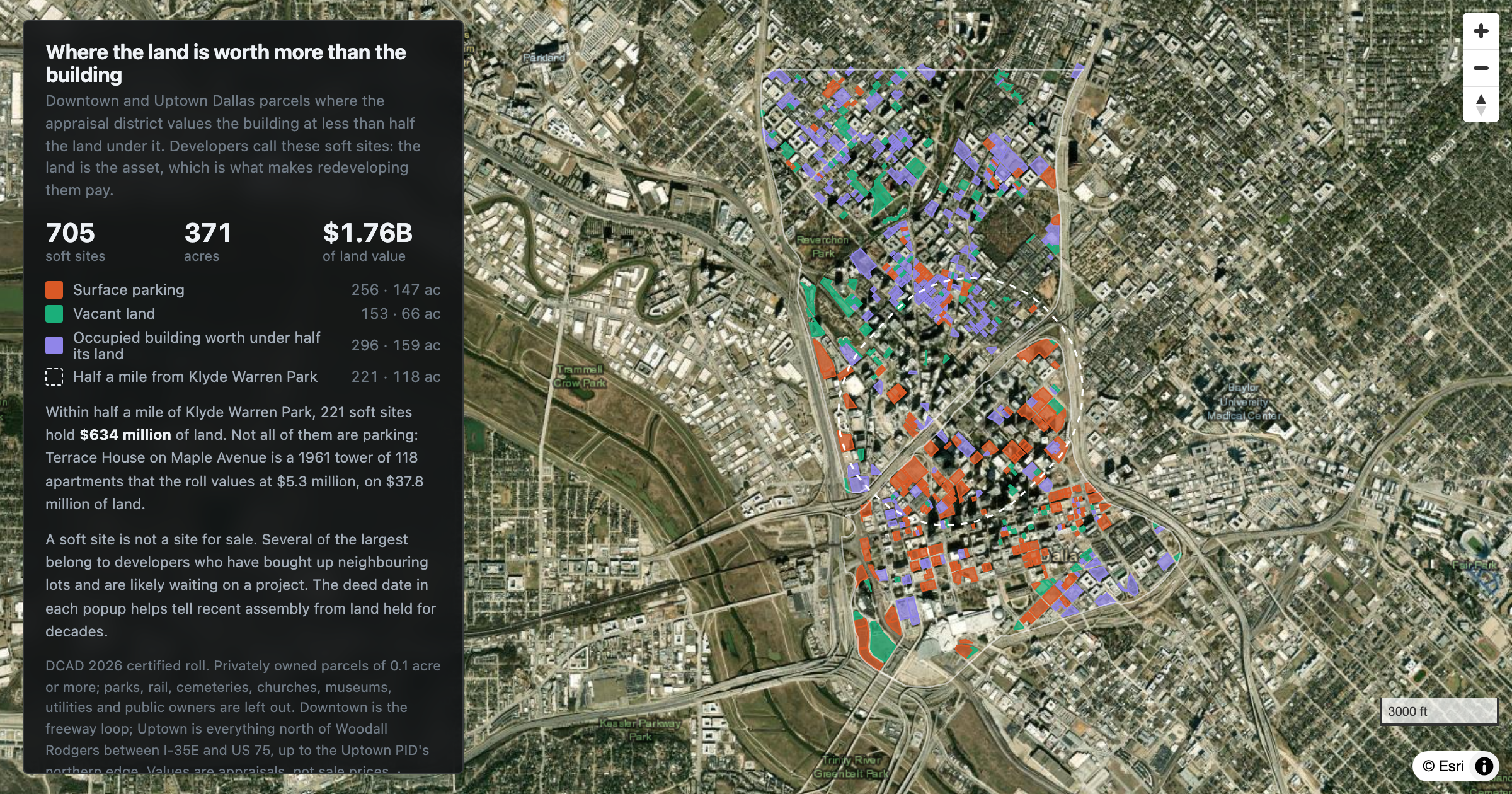
705 parcels in downtown and Uptown Dallas where the building is worth less than half the land under it: 371 acres and $1.76 billion of land.
Dallas
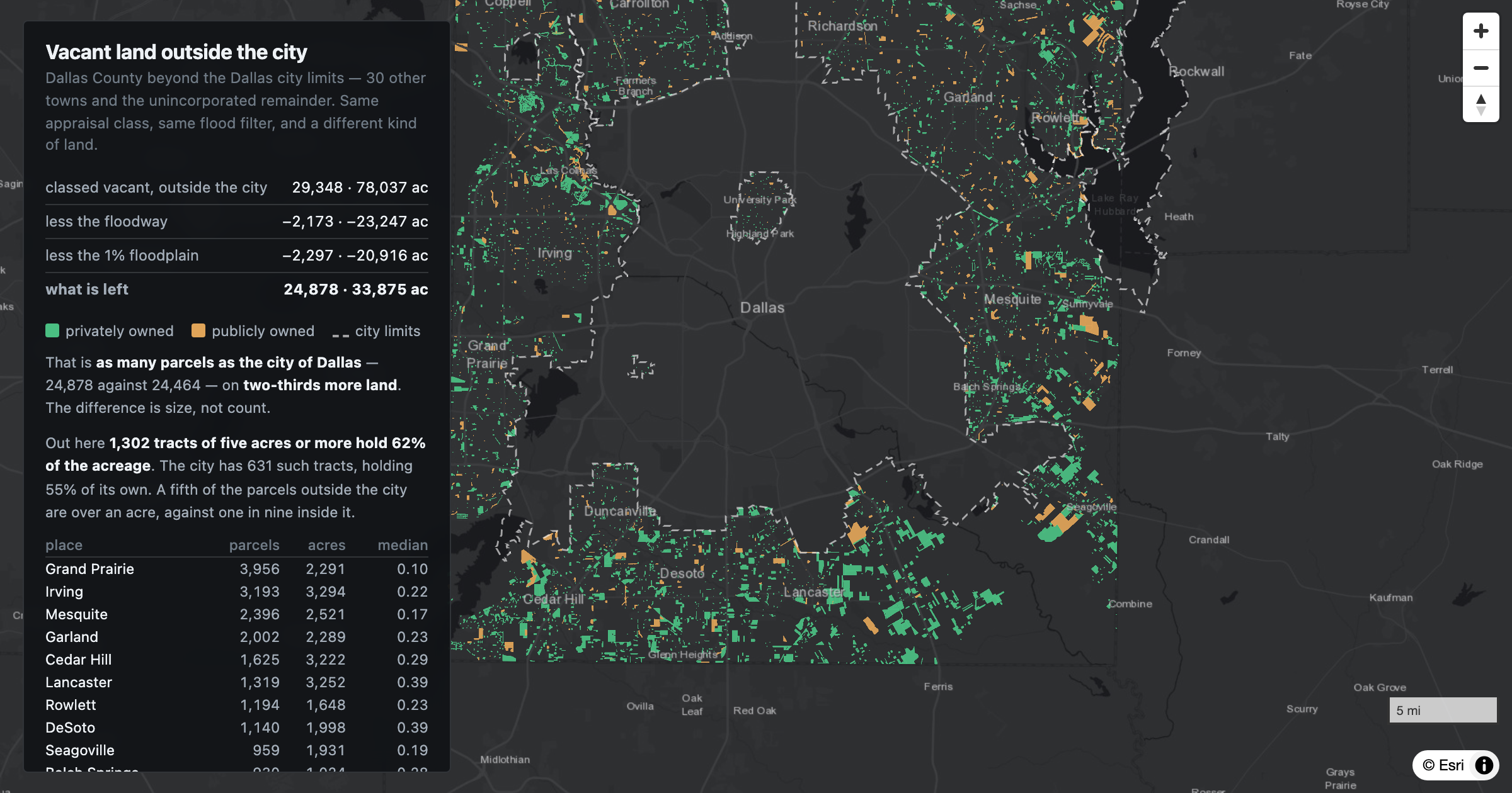
Outside the city limits, Dallas County holds 24,878 vacant parcels on 33,875 acres — as many parcels as the city and two-thirds more land. Grand Prairie, Irving, Mesquite and Garland lead on count; the southern county holds the acreage.
Dallas
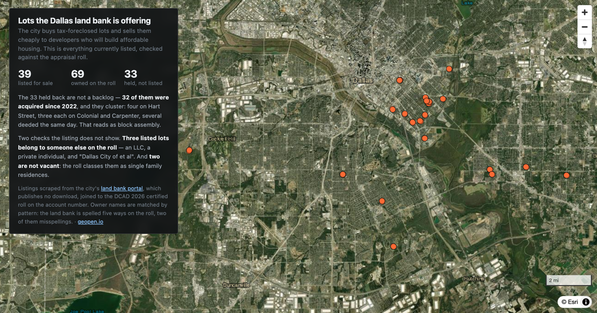
The Dallas land bank owns 69 parcels and lists 39 of them. Here is every one, joined to the appraisal roll.
Dallas
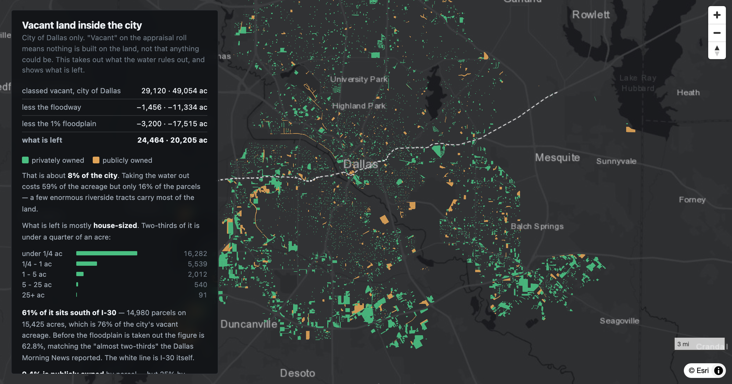
The city of Dallas has 29,120 parcels its appraisal district classes as vacant. Take out the floodway and the 1% floodplain and 24,464 are left, on 20,205 acres — two-thirds of them smaller than a quarter of an acre.
Texas
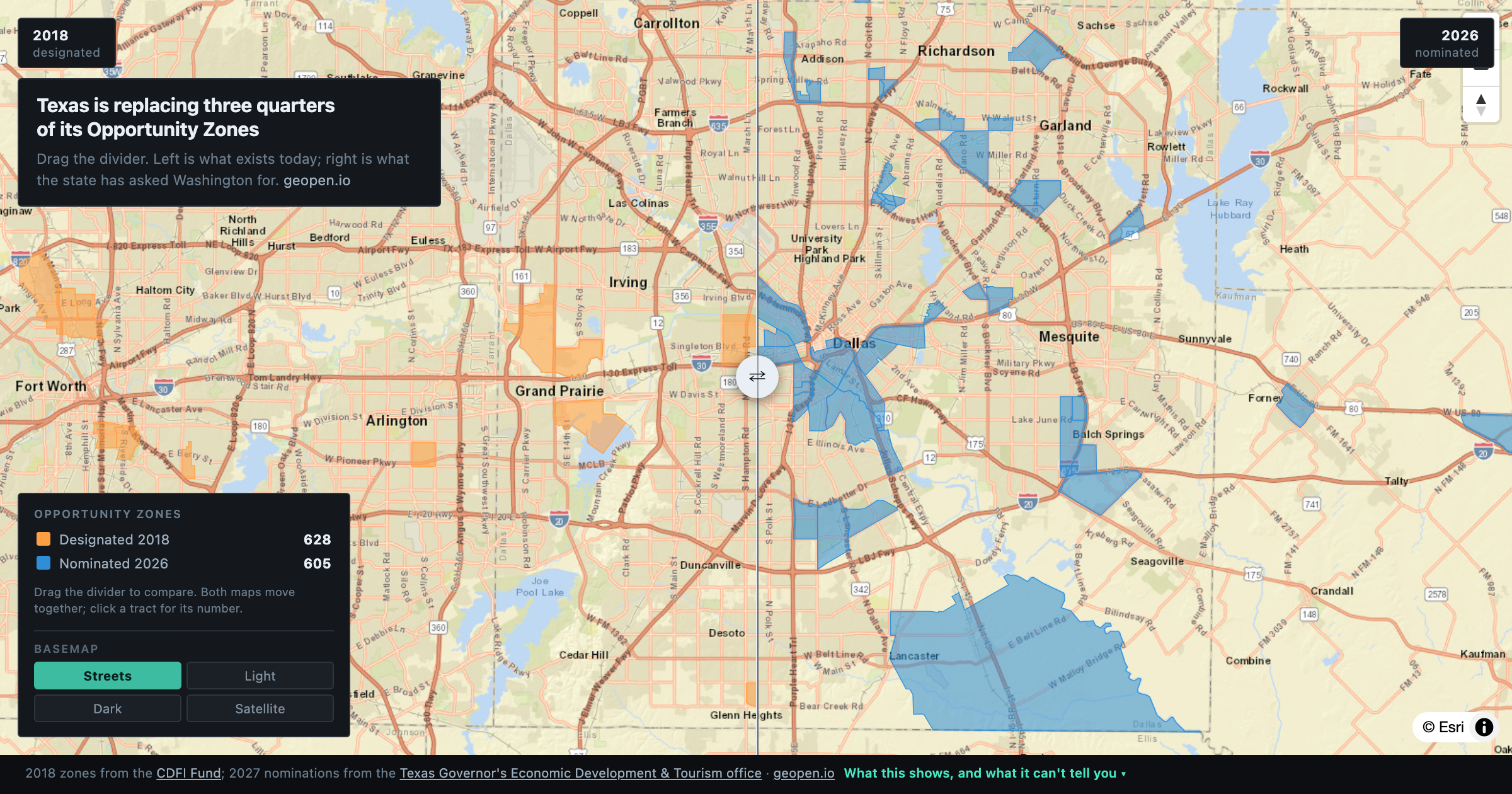
Drag to compare. Texas had 628 Opportunity Zones designated in 2018; it has nominated 605 different ones for 2027. Only 175 of the originals survive.
DFW
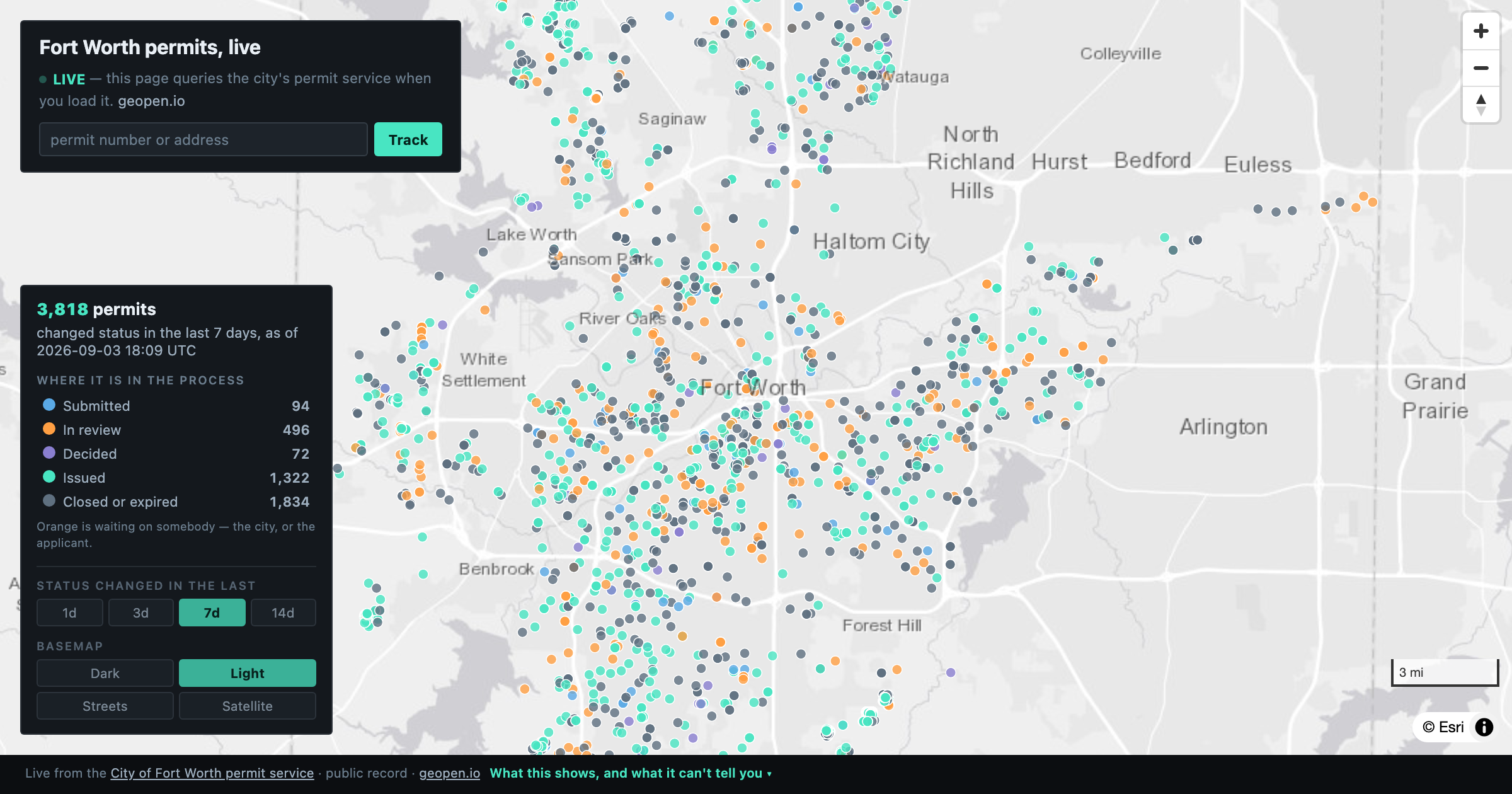
Every Fort Worth building permit that changed status in the last week, queried live from the city as you load the page. Search any permit number or address and see where it is in the process.
Texas
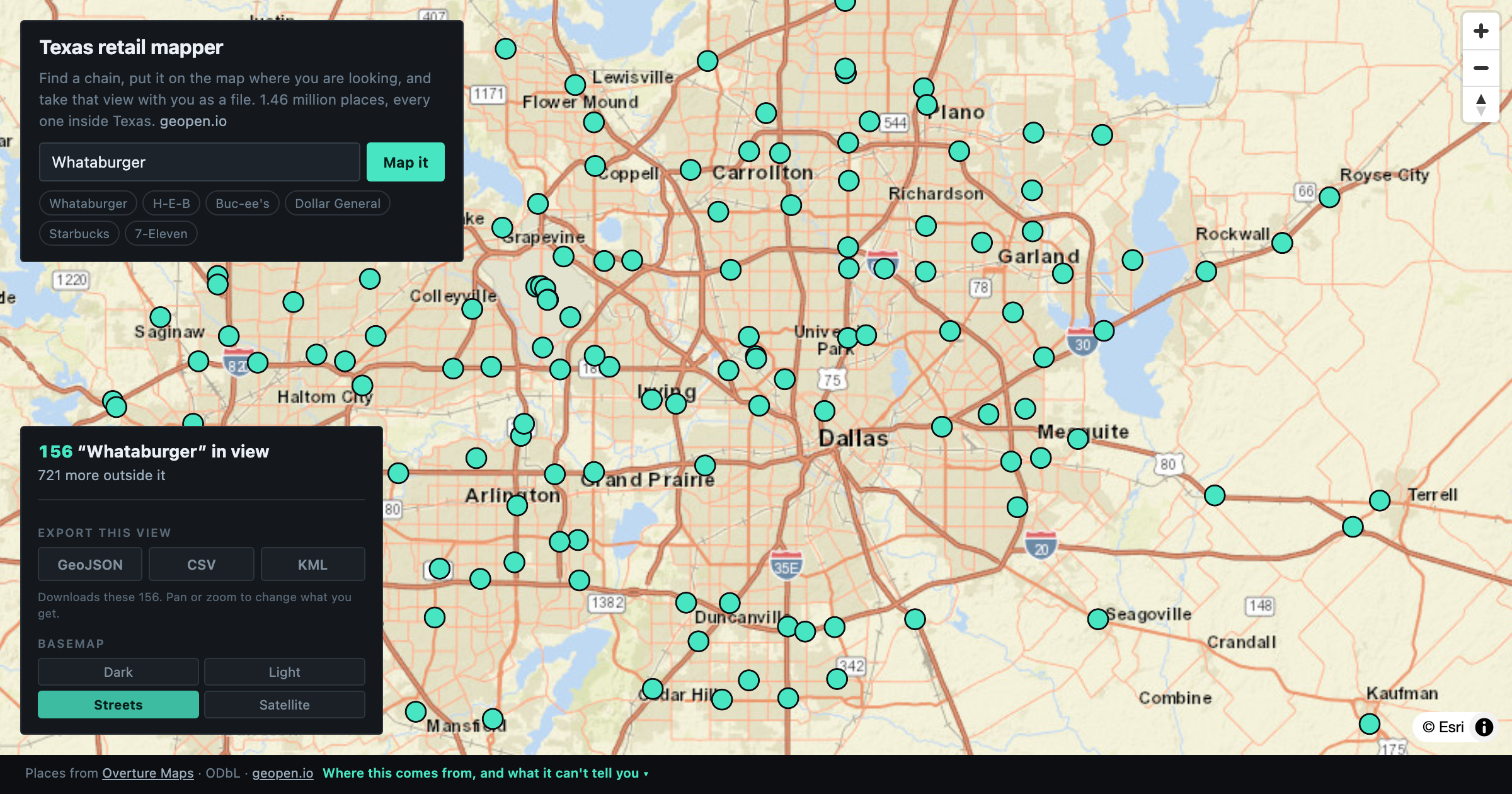
Find every location of any chain in Texas — Whataburger, H-E-B, Buc-ee's — map them, then export the view as GeoJSON, CSV or KML. 1.46 million places from Overture Maps.
U.S.
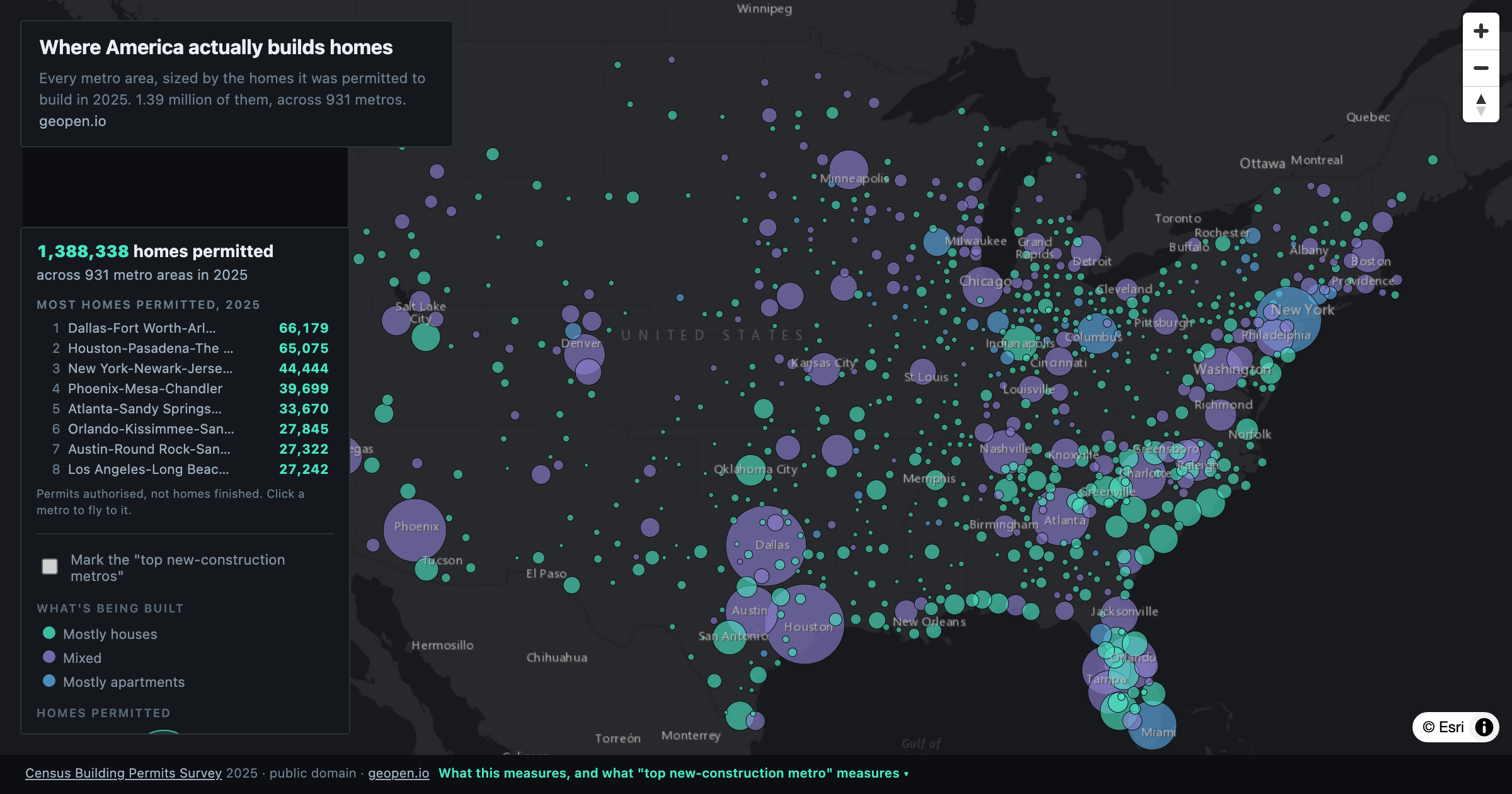
Every US metro sized by the homes it permitted in 2025. Dallas-Fort Worth leads the country with 66,179 units. The metro ranked best for new construction this year built 2,958.
Dallas
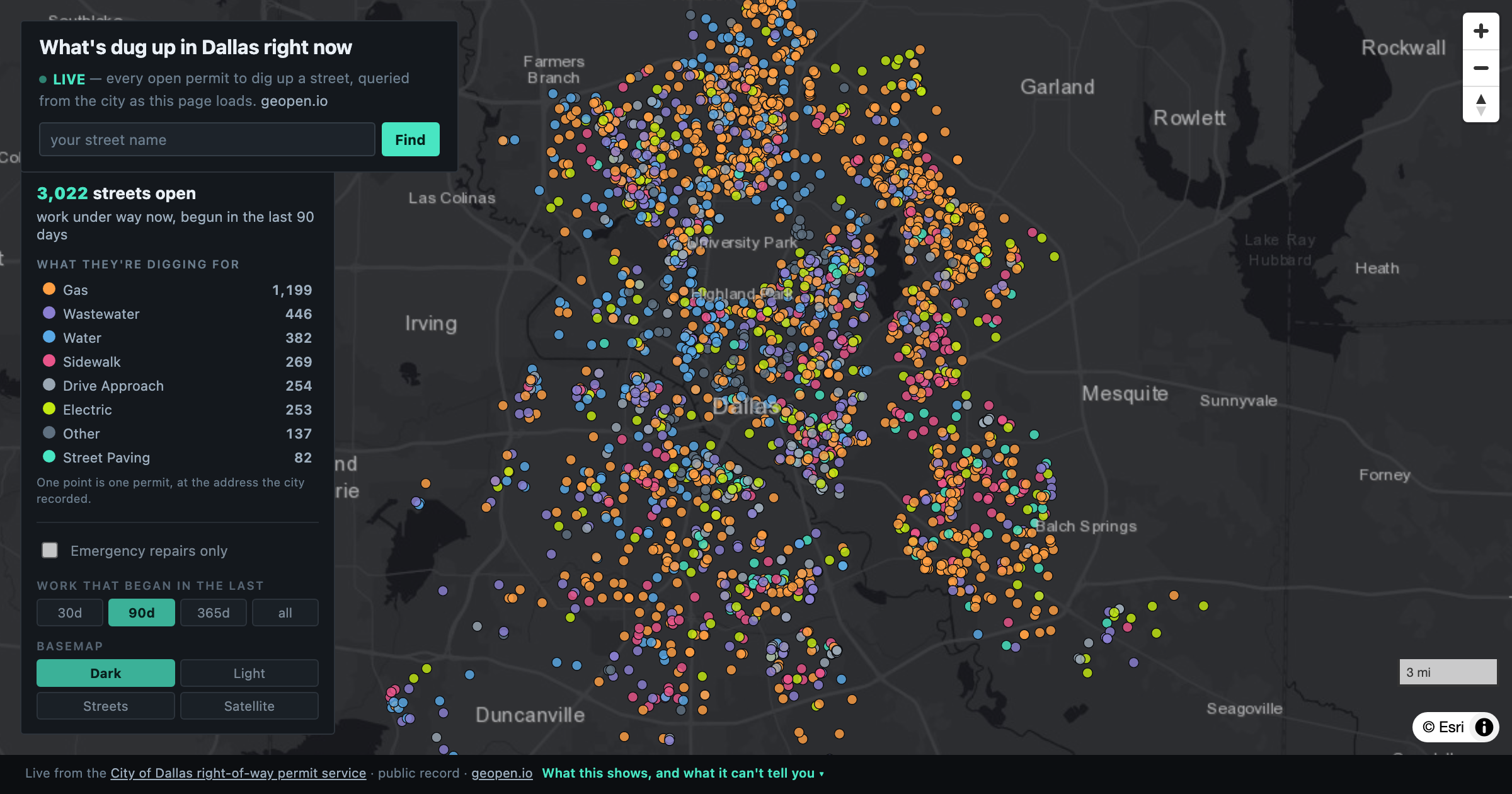
Every open right-of-way permit in Dallas, queried live from the city. Where the street is torn up, who is digging, what they are fixing, and when they said they would finish.
Texas
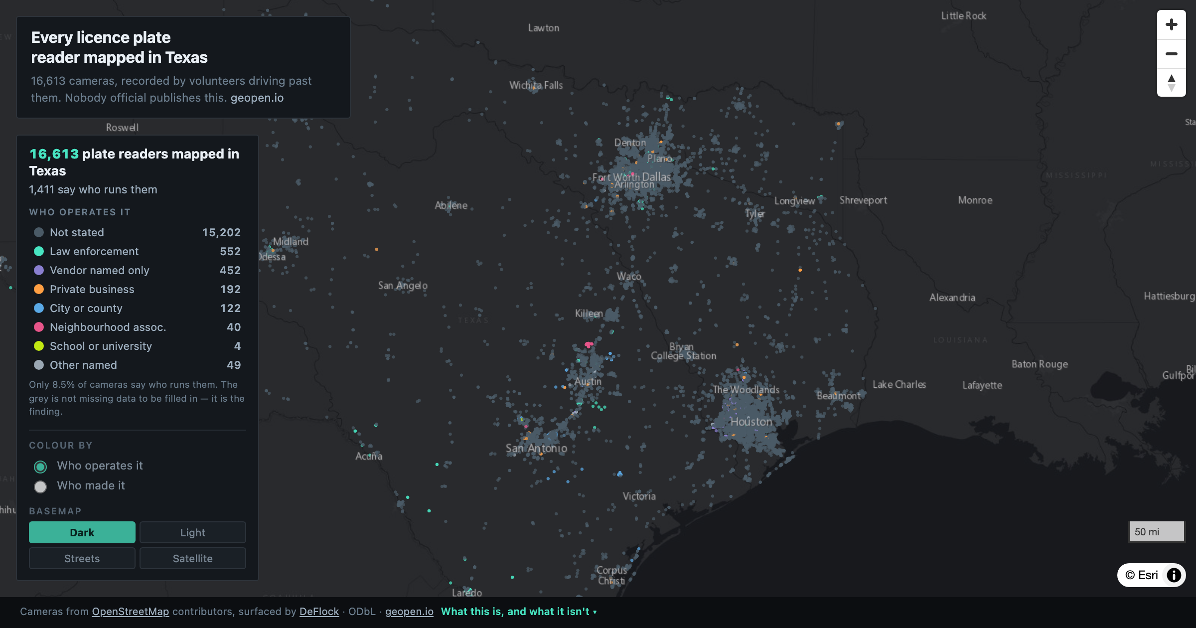
16,613 automatic licence plate readers across Texas, mapped by volunteers. 92% are Flock Safety. Only 8.5% say who runs them.
Texas
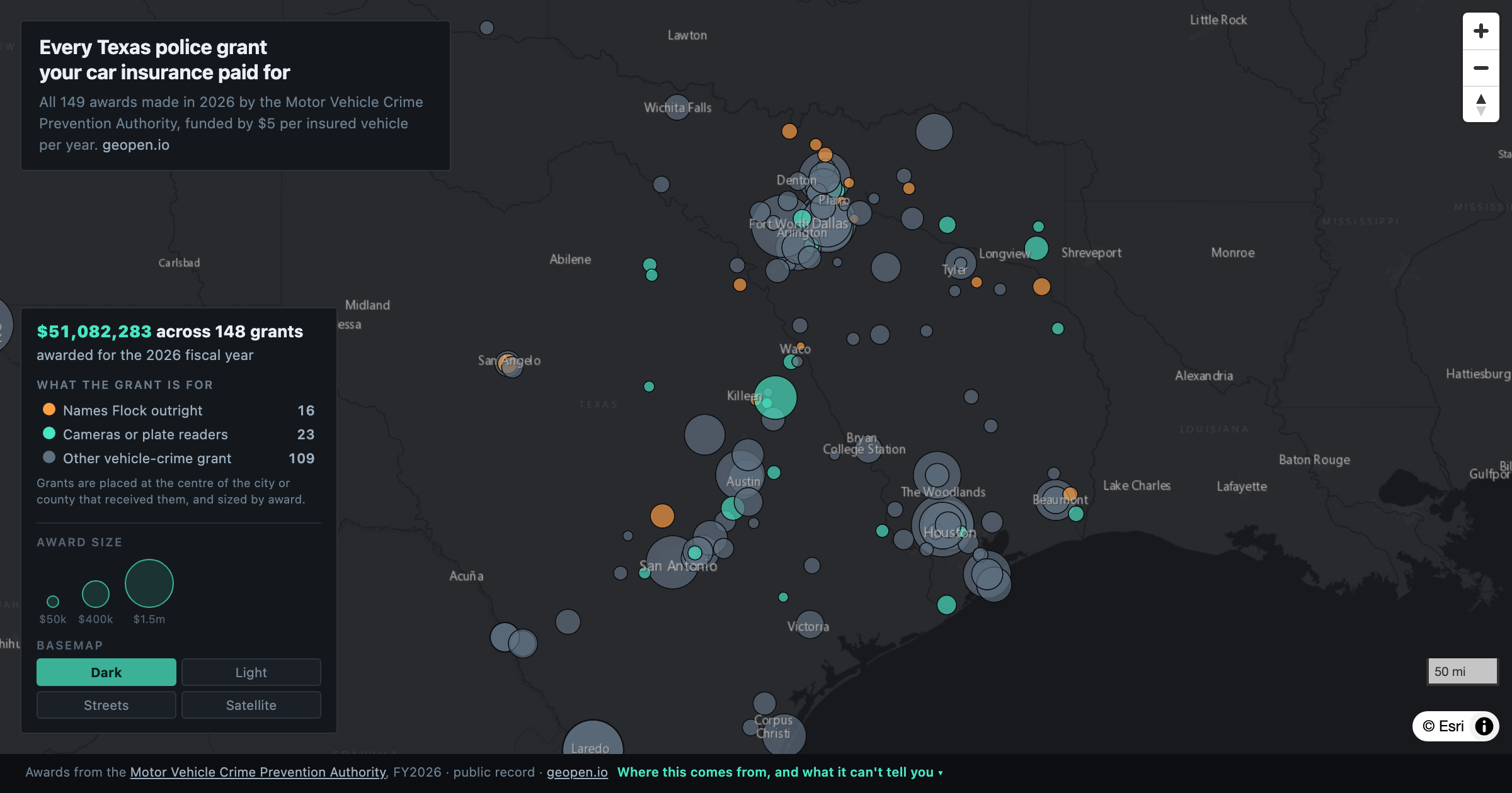
All 149 Texas MVCPA grants for 2026 — $51.2 million raised by a $5 fee on every insured vehicle. 39 name cameras or plate readers, and 38 of those sit in the catalytic converter programme.
DFW
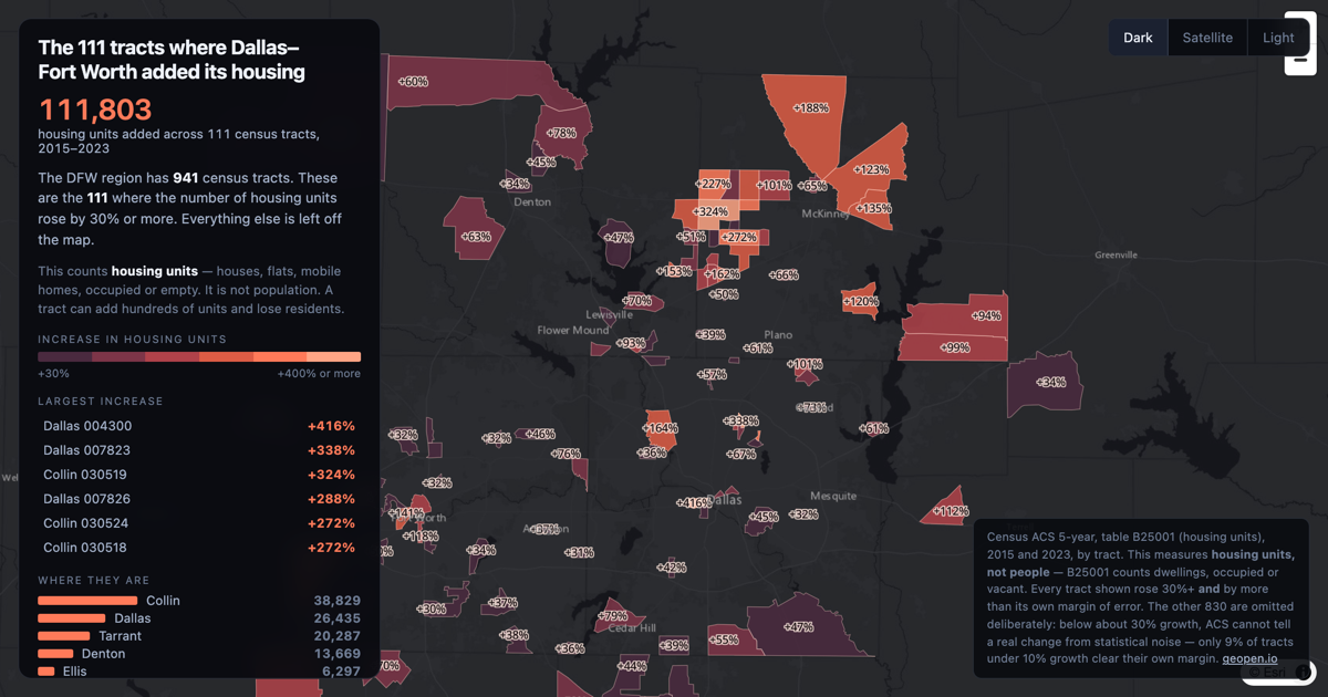
Of 941 census tracts across the DFW region, 111 added 30% or more to their housing unit count between 2015 and 2023 — 111,803 units between them.
DFW
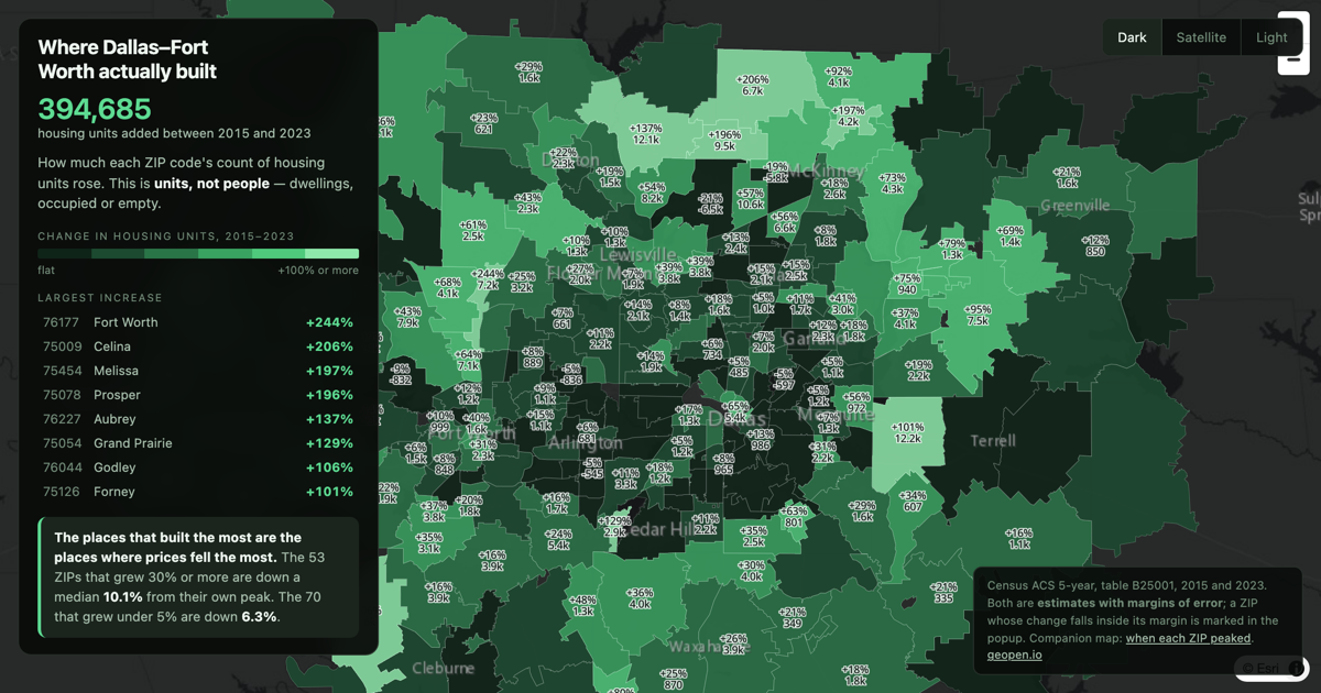
394,685 homes added across DFW between 2015 and 2023, by ZIP code. The places that built the most are the places where prices fell the most.
DFW
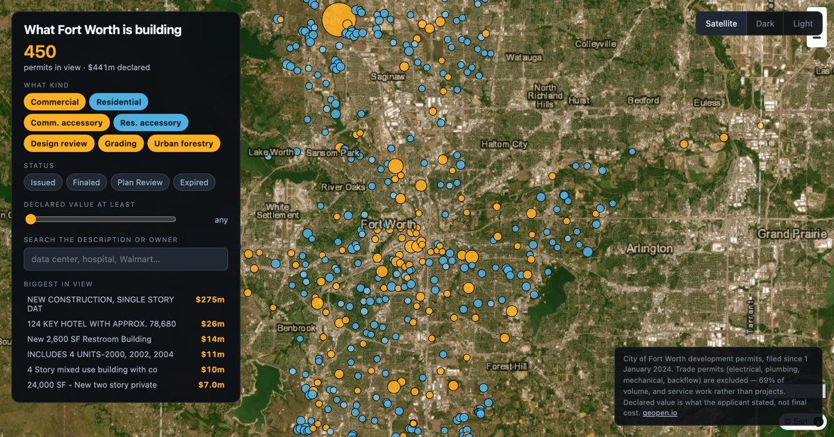
Every building permit Fort Worth has filed since January 2024 — 57,276 of them, $42.5 billion of declared work. Filter by type, status and value.
Texas
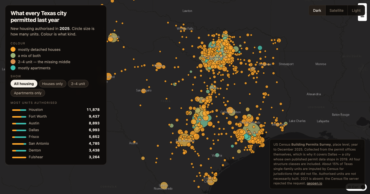
Every Texas city that authorised new housing in 2025, sized by units and coloured by what kind — houses or apartments. From the Census Building Permits Survey.
Texas
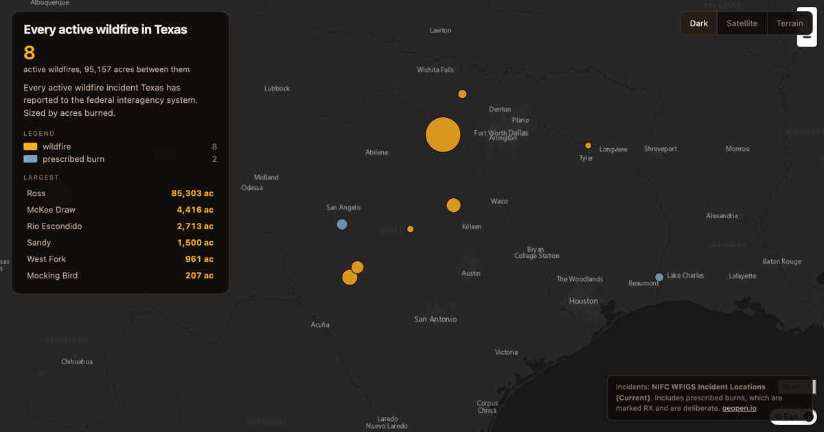
Current wildfire incidents in Texas from the federal interagency feed, sized by acres and labelled with containment.
Texas
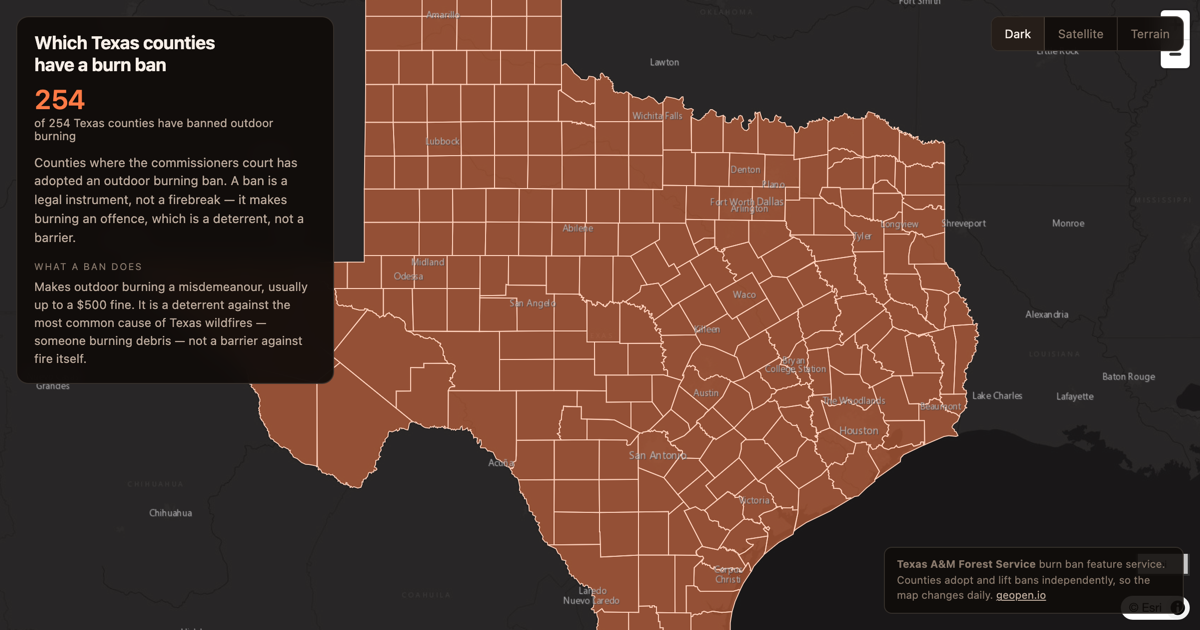
County burn bans across Texas from Texas A&M Forest Service. A ban makes outdoor burning an offence — it does not stop a fire.
Texas
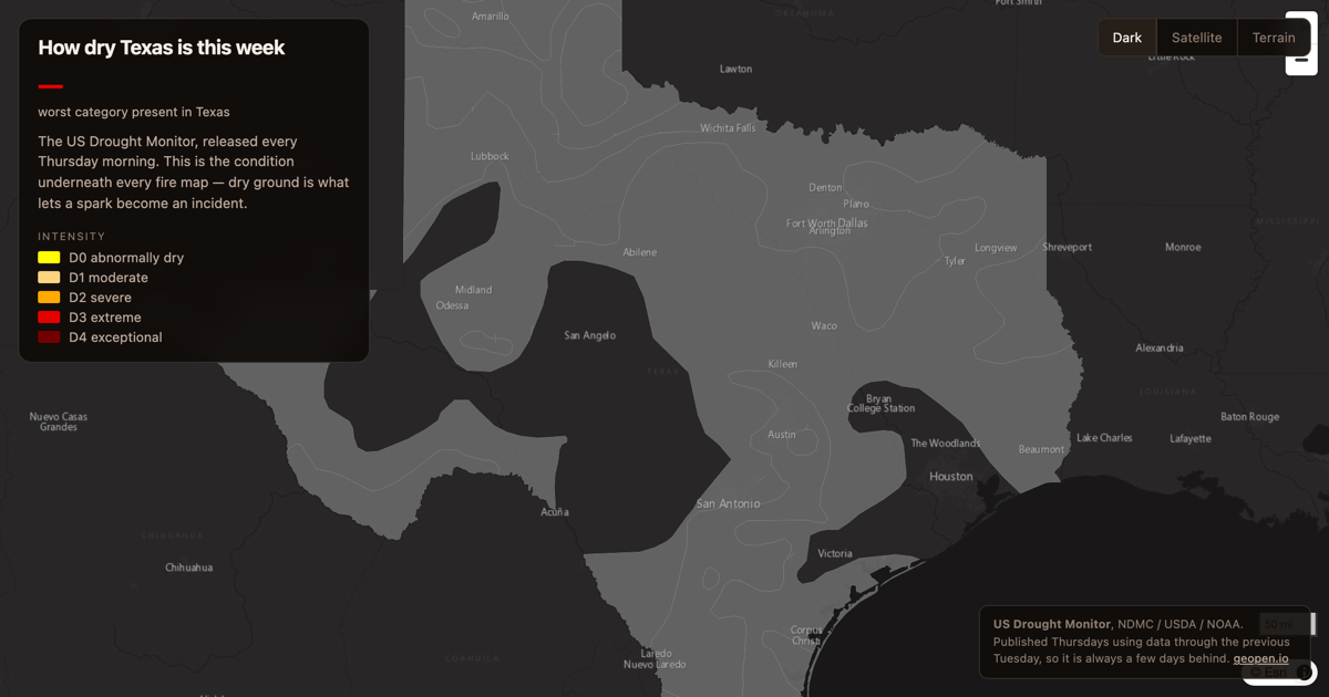
The US Drought Monitor for Texas, updated every Thursday. Drought is the condition that decides whether a spark becomes a fire.
Texas
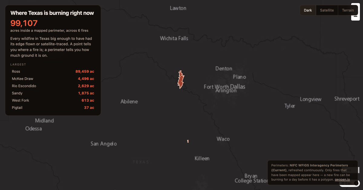
Every mapped wildfire perimeter in Texas, straight from the federal interagency feed. The Ross Fire in Palo Pinto County is 88,000 acres.
DFW
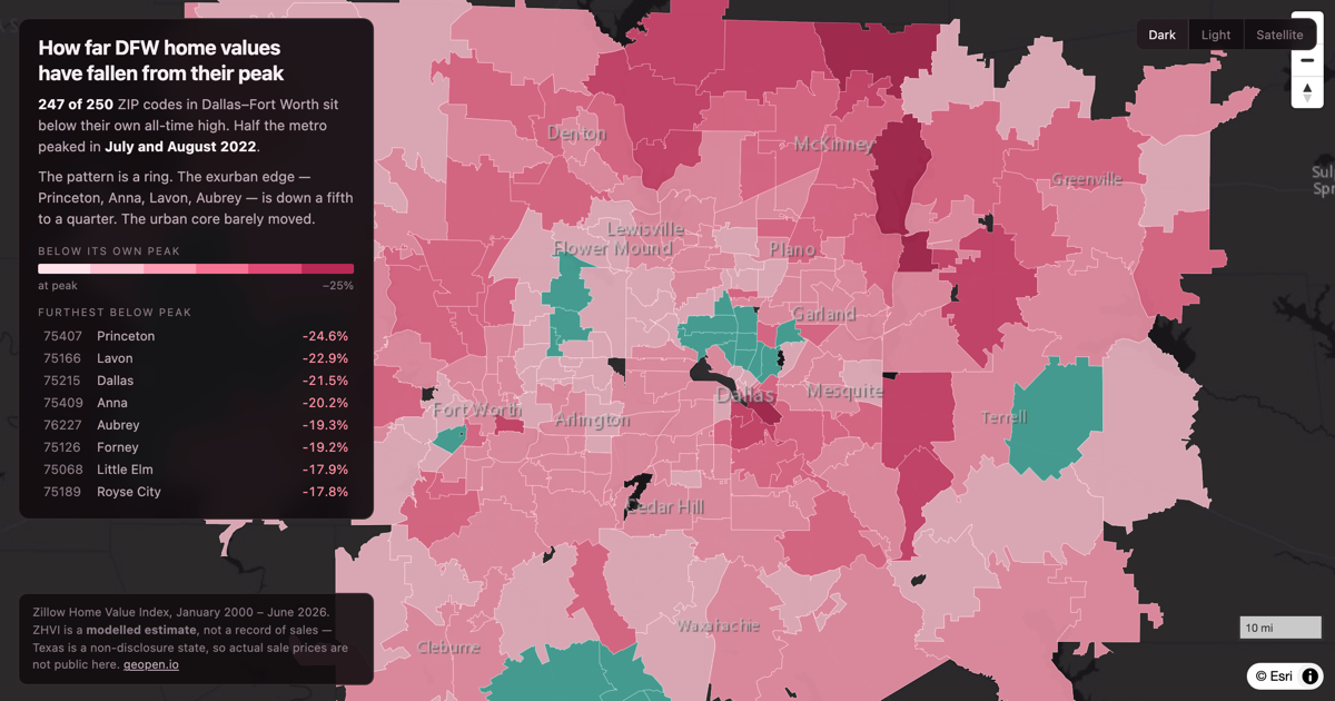
247 of 250 DFW ZIP codes sit below their own all-time high. The exurban edge is down a fifth to a quarter; the core barely moved.
DFW
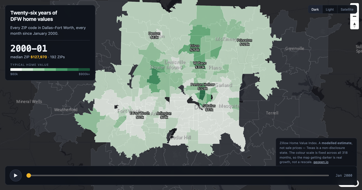
Every Dallas–Fort Worth ZIP code from January 2000 to June 2026. Press play and watch the map turn over.
DFW
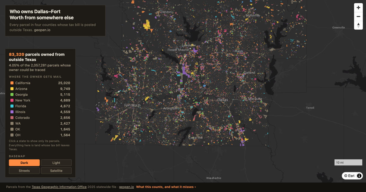
83,320 parcels across Dallas, Tarrant, Collin and Denton counties send their tax bill outside Texas — one in twenty-five. Click any parcel for its appraisal and deed records.
From What non-Texans own DFW? ·
DFW
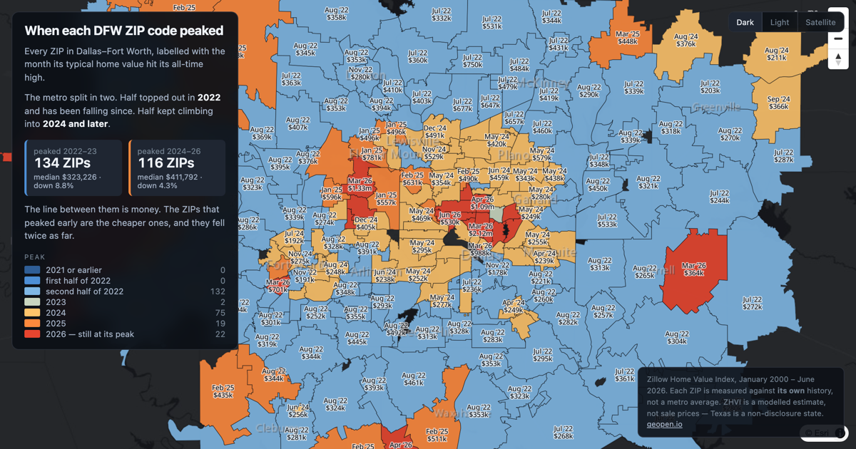
Half of Dallas–Fort Worth peaked in 2022. The other half kept climbing to 2024 and beyond. The line between them is money.
Texas
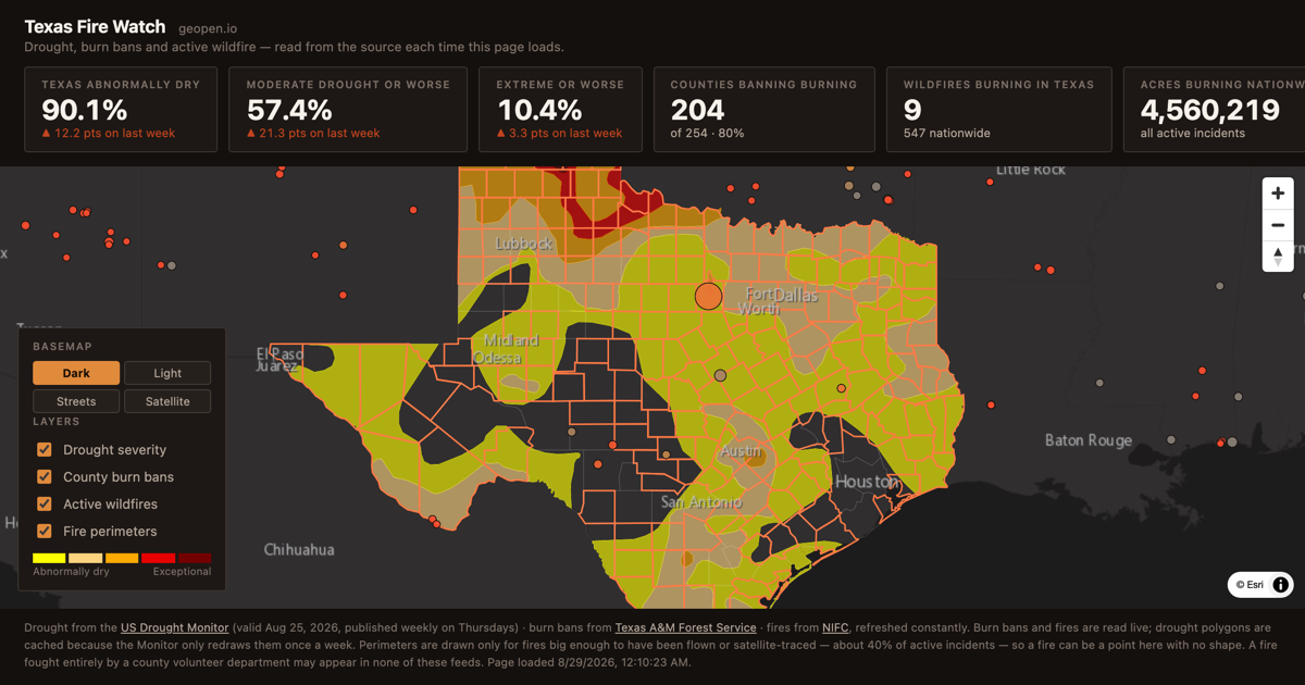
Live drought severity, county burn bans and active wildfires across Texas and the United States. Updated from the US Drought Monitor, Texas A&M Forest Service and NIFC every time you load the page.
From How dry & hot is it across Texas? A look at wildfires, drought and burn bans ·
Texas
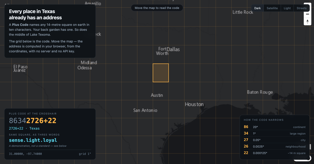
Plus Codes give every 14-metre square on earth a short address. The algorithm is open, the code runs in your browser, and nobody needs permission to use it.
Dallas
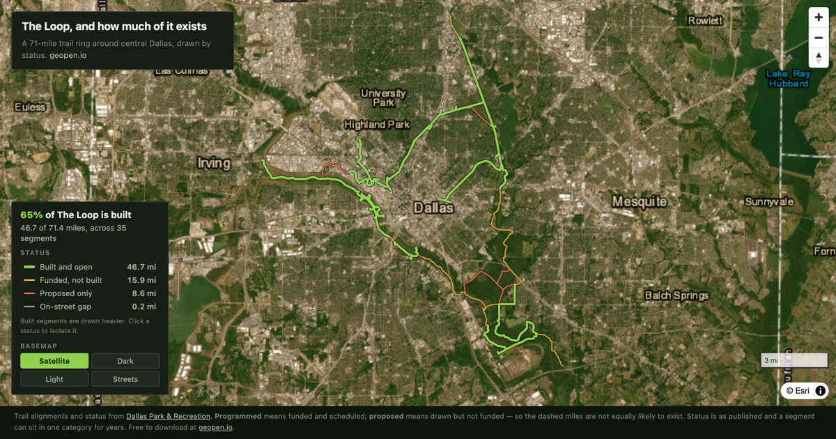
The Loop is a planned 71-mile trail circling central Dallas. 46.7 miles are built. This is which parts, and which parts are still a line on a map.
DFW
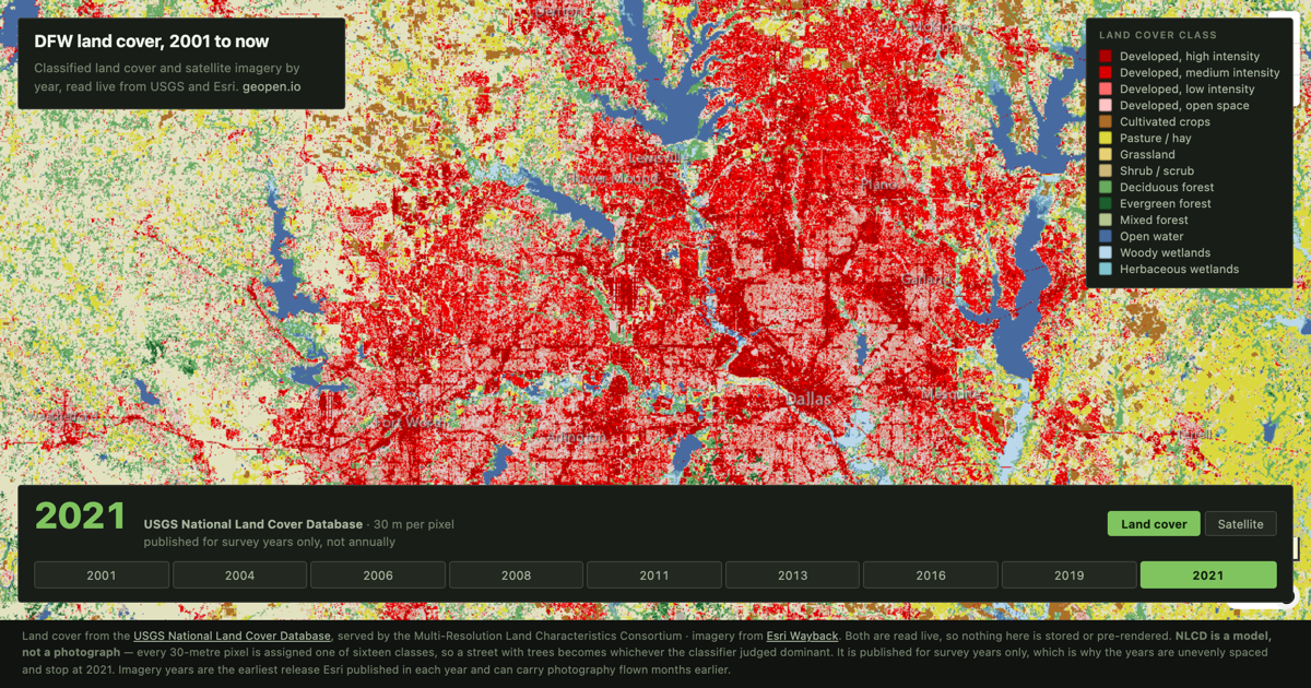
Land cover and satellite imagery for Dallas–Fort Worth by year. USGS NLCD 2001–2021 and Esri Wayback imagery 2014–2026, read live from the source.
Texas
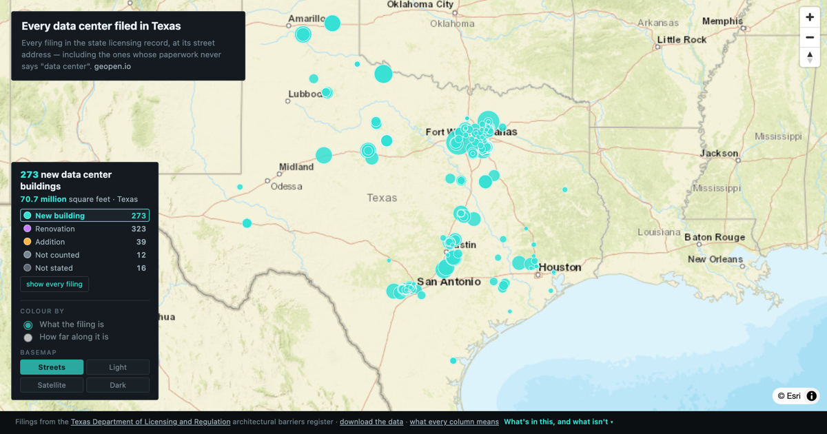
671 data center filings from the Texas licensing record, at their street addresses. 279 new buildings, 70.7 million square feet — and two thirds of it filed since the start of 2025.
Dallas
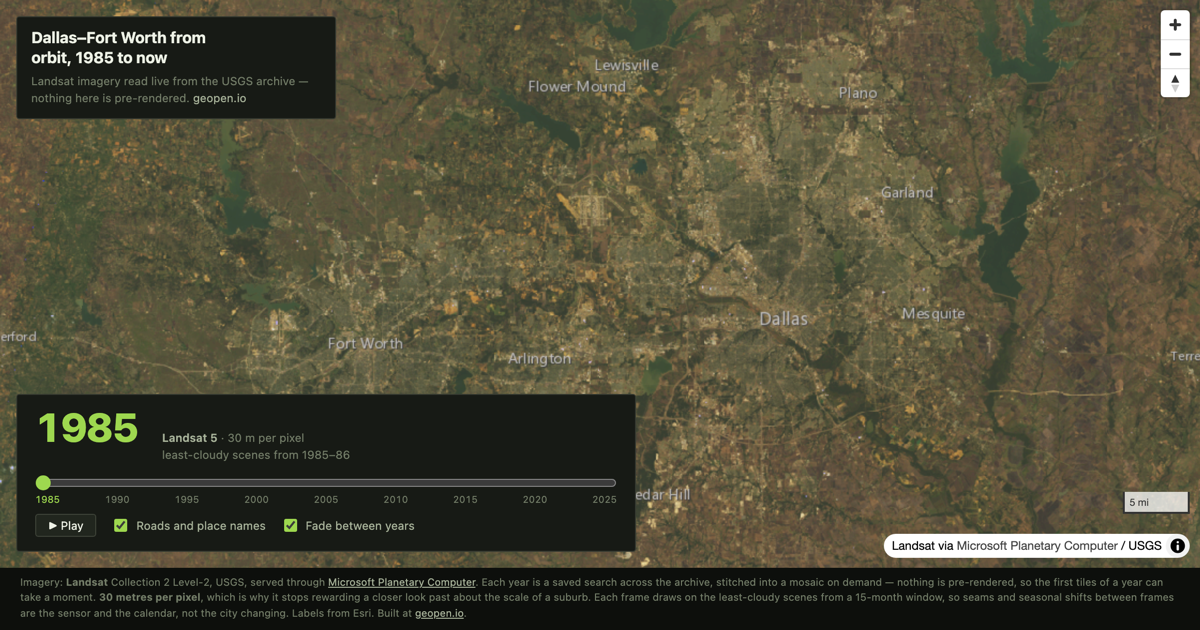
Landsat satellite imagery of Dallas–Fort Worth every five years from 1985, served live from the USGS archive. Drag the year and watch the metro spread.
Dallas
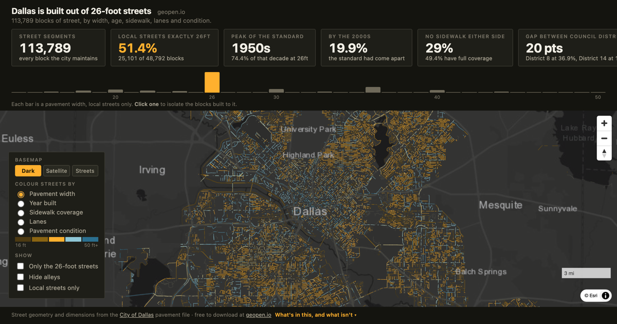
Every block of street in Dallas — 113,789 segments — by pavement width, year built, sidewalk coverage, lanes and condition. Half the city's local streets are exactly 26 feet wide.
Dallas
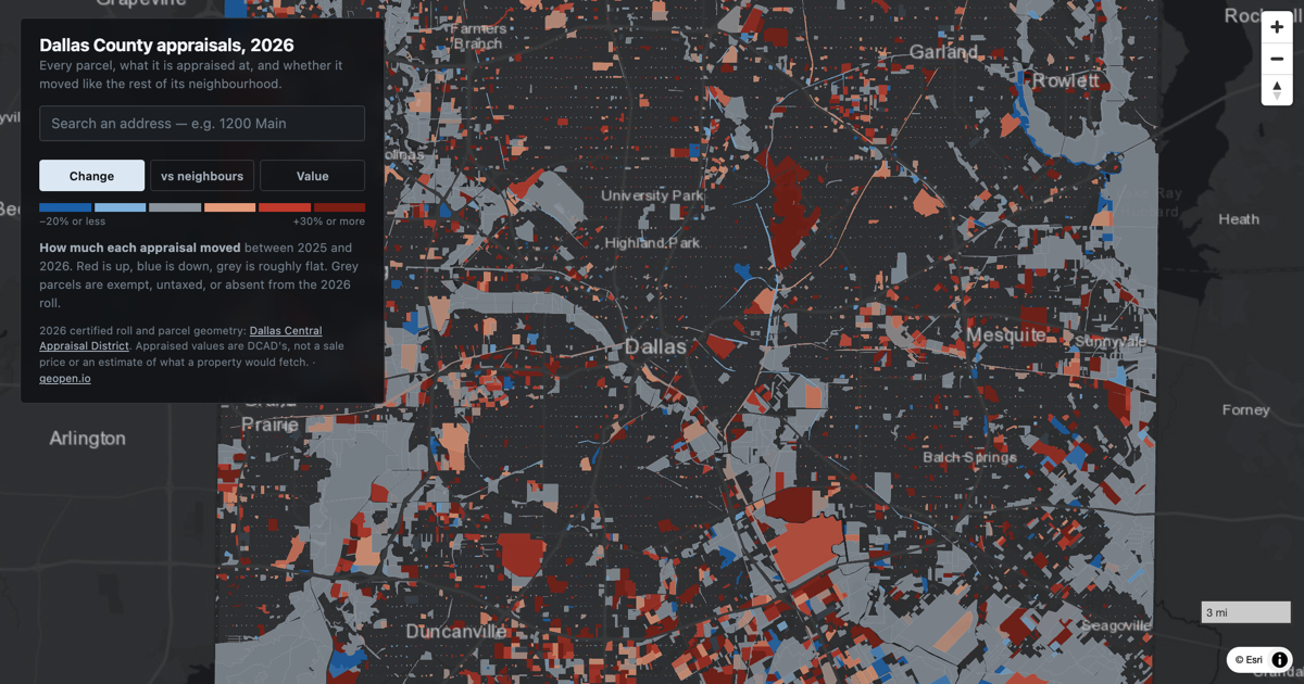
Every parcel in Dallas County with its 2026 appraisal, the change from last year, and how that change compares with the rest of its neighbourhood.
Texas
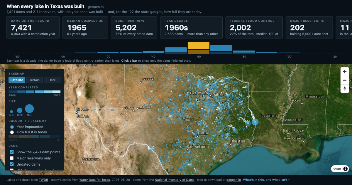
Completion years for 7,421 Texas dams — every reservoir in the state, when its dam was finished, how big it is and what it was for. Texas built half its lakes in a thirty-year window and has barely built one since.
Texas
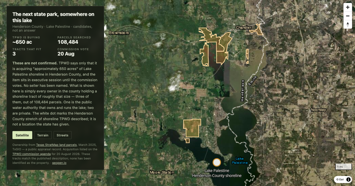
TPWD is buying about 650 acres on Lake Palestine and has not said whose. Only three owners in Henderson County hold shoreline tracts of that size.
Texas
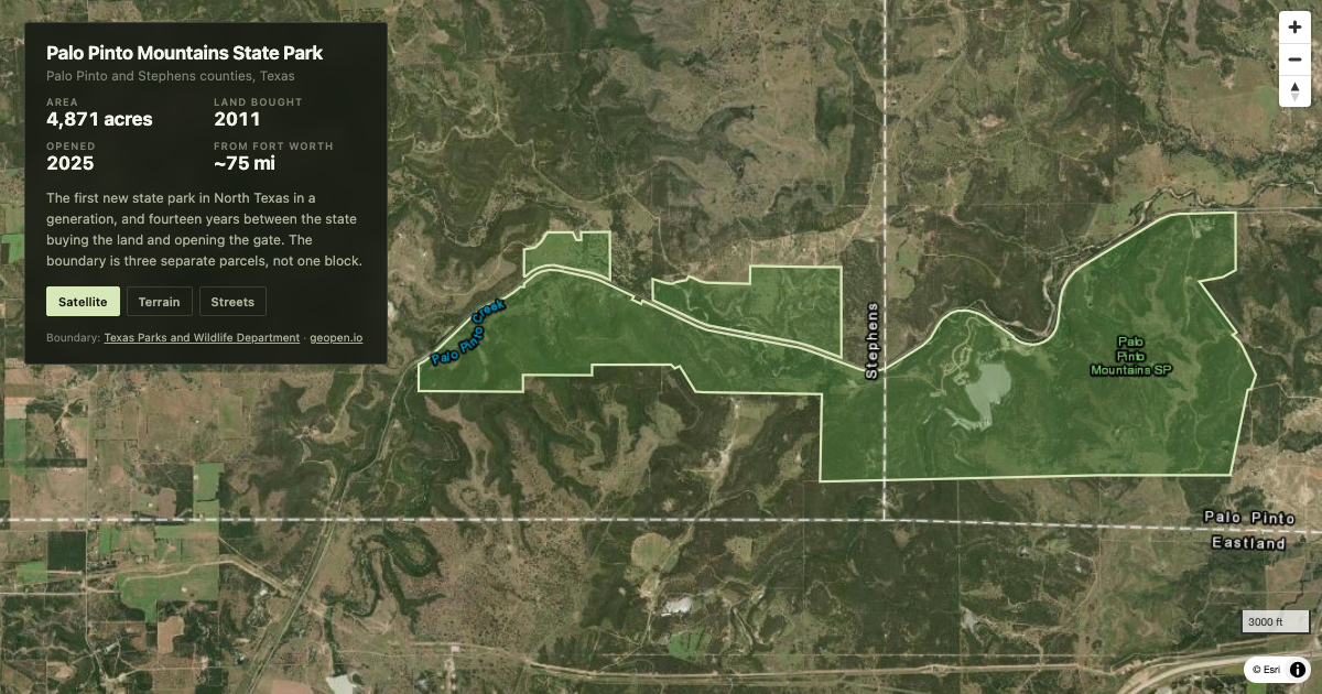
The 4,871-acre boundary of Palo Pinto Mountains State Park, the first new state park in North Texas in a generation, mapped from the Texas Parks and Wildlife Department's own data.
Texas
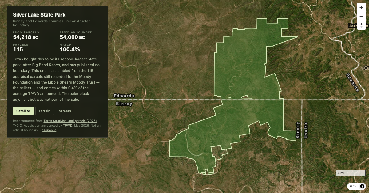
Texas bought a 54,000-acre Hill Country ranch to become its second-largest state park, and published no map. This is the boundary, reconstructed from 115 appraisal parcels.
DFW
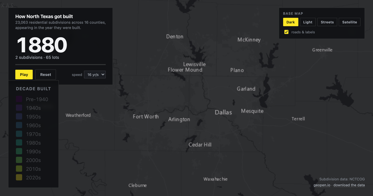
23,063 residential subdivisions across 16 North Texas counties, appearing in the year they were built. 1880 to 2023.
From Watch DFW get built ·